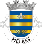
Melres

Melres
Melres
Wappen Karte
Wappen von Melres Lagekarte für Melres
Basisdaten
Region: Norte
Unterregion: Grande Porto
Distrikt: Porto
Concelho: Gondomar
Koordinaten: 41° 4′ N, 8° 24′ W41.068652-8.398235Koordinaten: 41° 4′ N, 8° 24′ W
Einwohner: 3.945 (Stand: 2001)
Fläche: 17,4 km²
Bevölkerungsdichte: 227 Einwohner pro km²
Politik
Adresse der Gemeindeverwaltung: Junta de Freguesia de Melres
Rua Padre Jerónimo n.º 100
4515-522 Melres
Webseite: www.jf-melres.com

Vorlage:Infobox Ort in Portugal/Wartung/Art ist leer

Vorlage:Infobox Ort in Portugal/Wartung/Karte ist ausgefüllt


Vorlage:Infobox Ort in Portugal/Wartung/Höhe ist leer Vorlage:Infobox Ort in Portugal/Wartung/PLZ ist leer Vorlage:Infobox Ort in Portugal/Wartung/Bürgermeister ist leer


Vorlage:Infobox Ort in Portugal/Wartung/Email ist leer

Melres ist eine Gemeinde im Norden Portugals.

Melres gehört zum Kreis Gondomar im Distrikt Porto, besitzt eine Fläche von 17,4 km² und hat 3.945 Einwohner (Stand: 2001).[1]

Einzelnachweise

  1. Daten zu Melres. alea.pt, abgerufen am 4. Juni 2011 (englisch).

Weblinks


Wikimedia Foundation.

Игры ⚽ Нужен реферат?

Schlagen Sie auch in anderen Wörterbüchern nach:

  • Melres — Freguesia de Portugal …   Wikipedia Español

  • Melres — is a town in Portugal and a parish of Gondomar. Coordinates: 41°04′N 8°24′W / 41.067°N 8.4°W / 41.067; 8.4 …   Wikipedia

  • Casa de Mellares — (Melres,Португалия) Категория отеля: Адрес: Rua padre Jerónimo 170 Melres, 4515 55 …   Каталог отелей

  • Мелреш — Посёлок Мелреш Melres Герб …   Википедия

  • Casa SanTiago — (Melres,Португалия) Категория отеля: Адрес: Av. Jose Joaquim Ferreira, 4515 462 Melre …   Каталог отелей

  • Районы округа Порту — …   Википедия

  • Sun tanning — describes a darkening of the skin (especially of fair skinned individuals) in a natural physiological response stimulated by exposure to ultraviolet (UV) radiation from sunshine or from artificial sources such as a tanning bed. With excessive… …   Wikipedia

  • Gondomar, Portugal — Gondomar (pron. IPA2|gõdu maɾ) is a city and a municipality located in the east of Portugal s Porto Metropolitan Area. The city has a population of 25,717 [ [http://62.48.187.117/atlas/Cap2/Cap2d 2.html UMA POPULAÇÃO QUE SE URBANIZA, Uma… …   Wikipedia

  • List of postal codes in Portugal — Aveiro districtMealhada municipality*3050 Antes *3050 Barcouço *3050 Casal Comba *3050 Luso *3050 Mealhada *3050 Pampilhosa *3050 Vacariça *3050 Ventosa do BairroMurtosa municipality*3870 Bunheiro *3870 Monte *3870 Murtosa *3870 TorreiraOliveira… …   Wikipedia

  • Covelo (Gondomar) — Covelo   Parish   Coat of arms …   Wikipedia

Share the article and excerpts

Direct link
Do a right-click on the link above
and select “Copy Link”