Midgham

Midgham
Qsicon Fokus2.svg Dieser Artikel wurde auf den Seiten der Qualitätssicherung eingetragen. Bitte hilf mit, ihn zu verbessern, und beteilige dich bitte an der Diskussion!
Folgendes muss noch verbessert werden: Bitte ausbauen--BuschBohne 17:07, 17. Okt. 2011 (CEST)
51.401-1.203
Midgham (Vereinigtes Königreich)
Midgham
Midgham

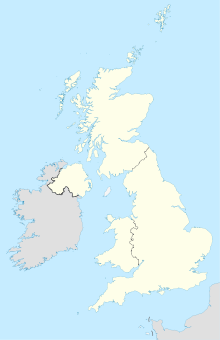
Midgham ist ein Dorf und Civil parish im Tal des River Kennet, etwa 4 km östlich von Newbury (Berkshire) und westlich von London. 2001 hatte es 282 Einwohner.

Mit Woolhampton teilt es sich die Midgham railway station an der Bahnstrecke Reading–Plymouth.

Weblinks


Wikimedia Foundation.

Игры ⚽ Поможем сделать НИР

Schlagen Sie auch in anderen Wörterbüchern nach:

  • Midgham — Coordinates: 51°24′04″N 1°12′11″W / 51.401°N 1.203°W / 51.401; 1.203 …   Wikipedia

  • Midgham railway station — Midgham Midgham Station, looking east. Location …   Wikipedia

  • Midgham Lock — Midgham Lock, with the road bridge in the background. Midgham Lock is a lock on the Kennet and Avon Canal, between Thatcham and Woolhampton, Berkshire, England. Midgham Lock was built between 1718 and 1723 under the supervision of the engineer… …   Wikipedia

  • Midgham Green — Coordinates: 51°24′26″N 1°11′19″W / 51.407187°N 1.188647°W / 51.407187; 1.188647 …   Wikipedia

  • High Sheriff of Berkshire — The High Sheriff of Berkshire, in common with other counties, was originally the King s representative on taxation upholding the law in Saxon times. The word Sheriff evolved from shire reeve . The title of High Sheriff is therefore much older… …   Wikipedia

  • Woolhampton — infobox UK place country= England official name= Woolhampton latitude= 51.397297 longitude= 1.176987 civil parish= Woolhampton unitary england= West Berkshire region= South East England lieutenancy england= Berkshire constituency westminster=… …   Wikipedia

  • Newbury, Berkshire — Coordinates: 51°24′03″N 1°19′25″W / 51.4009°N 1.3235°W / 51.4009; 1.3235 …   Wikipedia

  • West Berkshire — District Location of West Berkshire in Berkshire Geography Status: Unitary authority Region: South East England …   Wikipedia

  • Hungerford — For other uses, see: Hungerford (disambiguation) Coordinates: 51°24′52″N 1°30′53″W / 51.4144°N 1.5146°W / 51.4144; 1.5146 …   Wikipedia

  • List of places in Berkshire — This is a list of settlements in Berkshire, England. See the list of places in England for places in other counties. Many of the settlements listed here are , and any red links represent settlements that currently do not have enough knowledge… …   Wikipedia

Share the article and excerpts

Direct link
Do a right-click on the link above
and select “Copy Link”