Mount Virginia

Mount Virginia

f2

Mount Virginia

Photo-request.svg

Bild gesucht 

BWf1

Lage Antarktis
Gebirge Ellsworthgebirge
Geographische Lage 79° 15′ 0″ S, 84° 2′ 0″ W-79.25-84.033333333333Koordinaten: 79° 15′ 0″ S, 84° 2′ 0″ W
Mount Virginia (Antarktis)
Mount Virginia

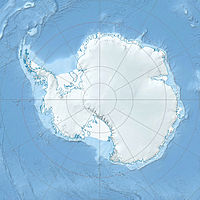
Mount Virginia ist ein Berg am nördlichen Ende eines Bergkamms in den Pioneer Heights in der westantarktischen Heritage Range. An diesem Berg treffen der Splettstoesser-Gletscher aus dem Südwesten und der Schmidt-Gletscher aus den Südosten aufeinander.[1]

Mount Virginia wurde vom United States Geological Survey im Rahmen der Erfassung des Ellsworthgebirges in den Jahren 1961–1966 durch Vermessungen vor Ort und Luftaufnahmen der United States Navy kartografiert. Benannt wurde der Gipfel vom Advisory Committee on Antarctic Names nach der Geographin Virginia S. Taylor, die von 1961 bis 1965 eine Mitarbeiterin des Komitees war.[1]

Einzelnachweise

  1. a b Mount Virginia (Englisch). Geographic Names Information System. United States Geological Survey. Abgerufen am 16. Juli 2010.

Wikimedia Foundation.

Игры ⚽ Нужно решить контрольную?

Schlagen Sie auch in anderen Wörterbüchern nach:

  • Mount Virginia — (79°15′S 84°2′W / 79.25°S 84.033°W / 79.25; 84.033) is a bare rock mountain at the north extremity of a ridge in the Pioneer Heights, Heritage Range. The mountain marks the point …   Wikipedia

  • Franklin County High School (Rocky Mount, Virginia) — Infobox School name = Franklin County High School imagesize = motto = Vires per scientiam (Strength through knowledge) established = 1950 grades = 9 12 district = Franklin County Public Schools type = Public high school principal = Debora Decker… …   Wikipedia

  • Virginia locations by per capita income — Virginia has the sixth highest per capita income of any state in the United States of America, at $23,975 (2000). Its personal per capita income is $33,671 (2003). Virginia Counties Ranked by Per Capita Income There are 135 counties and… …   Wikipedia

  • Rocky Mount, Virginia — Rocky Mount is a town in, and the county seat of, Franklin County, Virginia, United States.GR|6 The town is part of the Roanoke Metropolitan Statistical Area, and had a population of 4,066 at the 2000 census. HistoryFirst settled in 1760, Rocky… …   Wikipedia

  • Virginia (Begriffsklärung) — Virginia heißt in der Geografie: Virginia, Bundesstaat der Vereinigten Staaten West Virginia, Bundesstaat der Vereinigten Staaten Kolonie Virginia, britische Kolonie, aus der die gleichnamigen amerikanischen Bundesstaaten hervorgegangen sind… …   Deutsch Wikipedia

  • Locust Mount, Virginia — Locust Mount is an unincorporated community in Accomack County, Virginia.Reference* [http://geonames.usgs.gov/pls/gnispublic/f?p=138:3:16834937145767023180::NO::P3 FID:1499681 entry] …   Wikipedia

  • Mount Airy, Richmond County, Virginia — Mount Airy U.S. National Register of Historic Places U.S. National Historic Landmark …   Wikipedia

  • Mount de Chantal Visitation Academy — U.S. National Register of Historic Places …   Wikipedia

  • Mount Pleasant — may refer to: Contents 1 Place names 1.1 Australia 1.2 Canada 1 …   Wikipedia

  • Mount Storm Lake — and Power Plant Location Grant County, West Virginia Coordinates …   Wikipedia

Share the article and excerpts

Direct link
Do a right-click on the link above
and select “Copy Link”