Patoc

Patoc
Patoc

Photo-request.svg

Bild gesucht 

BWf1

Höhe 1.865 m
Lage Insel Luzon, Philippinen
Gebirge Philippinische Kordilleren
Geographische Lage 17° 8′ 46″ N, 120° 58′ 54″ O17.146111111111120.981666666671865Koordinaten: 17° 8′ 46″ N, 120° 58′ 54″ O
Patoc (Philippinen)
Patoc
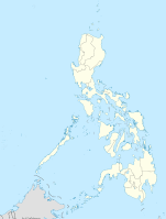
Typ Schichtvulkan
Gestein Andesit
Letzte Eruption unbekannt

Der Patoc ist ein 1.865 m hoher Vulkan auf den Philippinen.

Der Berg liegt in der Cordillera Central, einem Gebirgszug der Philippinischen Kordilleren, im Norden von Luzon, der größten Insel der Philippinen. An seiner Westflanke befinden sich das Dorf Mainit und der gleichnamige Bach. Die nächstgrößere Stadt ist Bontoc.

Der Patoc ist ein Schichtvulkan, der aus Andesit aufgebaut ist. Er zeigt eine starke furmarolische Aktivität.

Quelle

Weblinks


Wikimedia Foundation.

Игры ⚽ Поможем сделать НИР

Schlagen Sie auch in anderen Wörterbüchern nach:

  • pâţoc — PÂŢÓC s. v. guzgan, şobolan. Trimis de siveco, 13.09.2007. Sursa: Sinonime …   Dicționar Român

  • Dagami, Leyte —   Municipality   Seal …   Wikipedia

  • EDDHA — Chembox new ImageFile=EDDHA.png ImageSize=200px IUPACName=2 [2 [ [2 Hydroxy 1 (2 hydroxyphenyl) 2 oxoethyl] amino] ethylamino] 2 (2 hydroxyphenyl)acetic acid OtherNames=Ethylenediamine N,N bis(2 hydroxyphenylacetic acid Section1= Chembox… …   Wikipedia

  • Suyo, Ilocos Sur — Suyo is a 4th class municipality in the province of Ilocos Sur, Philippines. According to the 2000 census, it has a population of 9,685 people in 1,859 households.BarangaysSuyo is politically subdivided into 8 barangays.* Baringcucurong * Cabugao …   Wikipedia

  • Leptospira — Taxobox color = lightgrey name = Leptospira image width = 240px image caption = Scanning electron micrograph of Leptospira interrogans . regnum = Monera phylum = Spirochaetes classis = Spirochaetes ordo = Spirochaetales familia = Leptospiraceae… …   Wikipedia

  • Bucay — Municipality of Bucay Lage von Bucay in der Provinz Abra Basisdaten Bezirk: Regierungsbezirk …   Deutsch Wikipedia

  • Philippinische Kordilleren — f1p5 Philippinische Kordilleren Militärkarte mit den Gebirgszügen im Nordteil der Insel Luzón Höchster Gipfel Mount Pulag ( …   Deutsch Wikipedia

  • Raccolana — Das Raccolanatal (italienisch Val Raccolana, friaulisch Cjanâl di Racolane) liegt in den julischen Alpen. Das 13 km lange Tal liegt im Gebiet der Gemeinde Chiusaforte, in der Provinz Udine. Es erstreckt sich von West nach Ost und hat eine… …   Deutsch Wikipedia

  • Raccolanatal — 46.40128888888913.400744444444 Koordinaten: 46° 24′ 4,6″ N, 13° 24′ 2,7″ O …   Deutsch Wikipedia

  • Suyo — Municipality of Suyo Lage von Suyo in der Provinz Ilocos Sur Basisdaten Bezirk: Iloco …   Deutsch Wikipedia

Share the article and excerpts

Direct link
Do a right-click on the link above
and select “Copy Link”