Chigmit Mountains

Chigmit Mountains

p1p5

Chigmit Mountains
Lake Clark National Park.jpg
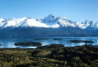
Höchster Gipfel Mount Redoubt (3.108 m)
Lage Alaska, USA
Teil der Aleutenkette
Chigmit Mountains (Alaska)
Chigmit Mountains
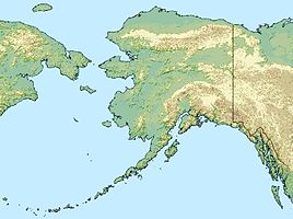
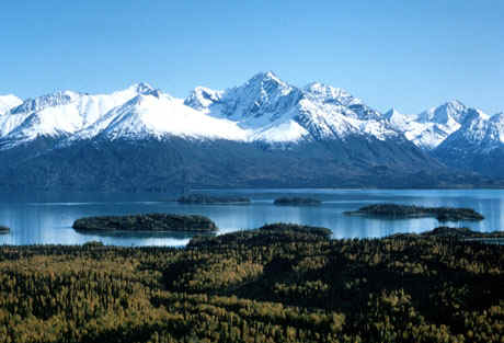
Koordinaten 60° 13′ N, 153° 24′ W60.216666666667-153.43108Koordinaten: 60° 13′ N, 153° 24′ W
Fläche 14.662 km²

Die Chigmit Mountains sind ein Gebirgszug der Aleutenkette auf der Alaska-Halbinsel in Alaska, etwa 200 km südwestlich von Anchorage. Sie liegen an der Westküste des Cook Inlets und bedecken mit einer Ausdehnung von 195 km in nordsüdlicher und 187 km in ostwestlicher Richtung eine Fläche von 14.662 km².
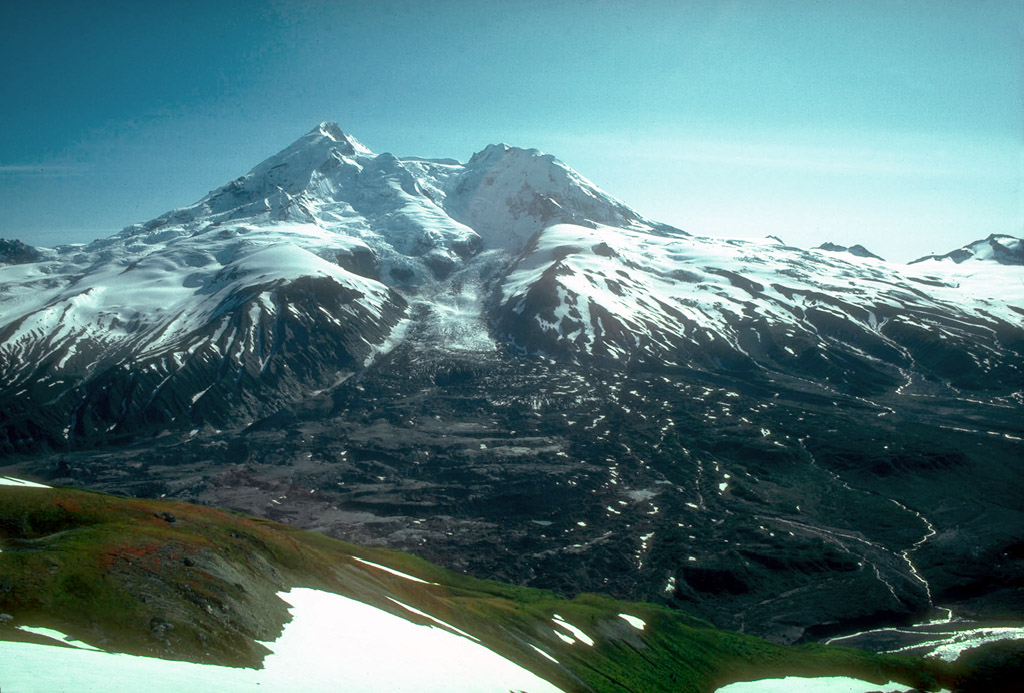
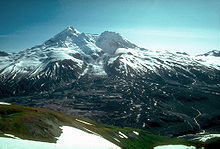
Mount Redoubt

Der höchste Berg der Chigmit Mountains und auch der Aleutenkette ist der Mount Redoubt mit einer Höhe von 3.108 m.

Die Chigmit Mountains sind das Bindeglied der Aleuten- zur Alaskakette. Sie grenzen im Norden an die Tordrillo Mountains und im Nordwesten an die Neacola Mountains und haben mit dem Mount Redoubt und dem Mount Iliamna zwei bedeutende Schichtvulkane.

Der Lake-Clark-Nationalpark ist Teil der Chigmit Mountains.

Berge der Chigmit Mountains

Weblinks

 Commons: Chigmit Mountains – Sammlung von Bildern, Videos und Audiodateien

Wikimedia Foundation.

Игры ⚽ Нужно сделать НИР?

Schlagen Sie auch in anderen Wörterbüchern nach:

  • Chigmit Mountains — Range Redoubt s north face Country …   Wikipedia

  • Neacola Mountains — Range Blockade Glacier in the Neacola Mountains Name origin …   Wikipedia

  • Tordrillo Mountains — Geobox | Range name=Tordrillo Mountains image caption=Mount Spurr from the south etymology= country=United States state=Alaska parent= border=Chigmit Mountains| border1=Alaska Range geology= | period= | orogeny= length imperial=| length… …   Wikipedia

  • List of mountains of the United States — This list of mountains of the United States includes significant mountain peaks and high points located in the United States of America arranged alphabetically by state, district, or territory.ignificant mountain peaks and high points Alabama… …   Wikipedia

  • Tordrillo Mountains — p1 Tordrillo Mountains Mount Spurr in den Tordrillo Mountains Höchster Gipfel Mount Torbert (3.479 m …   Deutsch Wikipedia

  • Liste der Berge in Alaska — Mount McKinley In Alaska befindet sich mit dem Mount McKinley der höchste Berg Nordamerikas und der nördlichster Berg der Erde über 5000 m. Der Mount Saint Elias, der zweithöchste Berg der USA und Kanadas, ist der relativ höchste Berg der Welt.… …   Deutsch Wikipedia

  • Aleutian Range — Geobox|Range name=Aleutian Range image caption=Alaska Peninsula, Peulik Volcano and Ukinrek Maars etymology= country=United States state=Alaska unit= border=Tordrillo Mountains geology= | period= | orogeny= length imperial=| length orientation=… …   Wikipedia

  • Aleutian Range — Alëutenkette auf der Alaska Halbinsel mit einigen Vulkanen Die Aleutenkette, auch Alëutenkette, (engl.: Aleutian Range) ist ein Gebirgszug auf der Alaska Halbinsel (Alaska, USA). Er erstreckt sich vom Chakachamna Lake (130 km westlich von… …   Deutsch Wikipedia

  • Alëutenkette — auf der Alaska Halbinsel mit einigen Vulkanen Die Aleutenkette, auch Alëutenkette, (engl.: Aleutian Range) ist ein Gebirgszug auf der Alaska Halbinsel (Alaska, USA). Er erstreckt sich vom Chakachamna Lake (130 km westlich von Anchorage) bis zur… …   Deutsch Wikipedia

  • Mountain peaks of Alaska — Mount McKinley (Denali) is the highest mountain peak of the State of Alaska, the United States of America, and all of North America. Main article: Geography of Alaska See also: Mountain peaks of the United States This article comprises three sor …   Wikipedia

Share the article and excerpts

Direct link
Do a right-click on the link above
and select “Copy Link”