Petenwell Lake

Petenwell Lake
Petenwell Lake

Photo-request.svg

Bild gesucht 

BW

Zuflüsse: Wisconsin River
Abflüsse: Wisconsin River
Größere Städte in der Nähe: Necedah
Petenwell Lake (Wisconsin)
Petenwell Lake
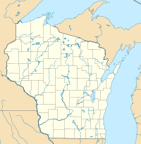
Koordinaten 44° 10′ 8,4″ N, 89° 57′ 19,1″ W44.169-89.9553Koordinaten: 44° 10′ 8,4″ N, 89° 57′ 19,1″ W
Daten zum Bauwerk
Daten zum Stausee
Höhe des Stauziels: 272 m
Wasseroberfläche bei Vollstau: 93 km²

Der Petenwell Lake ist ein Stausee am Wisconsin River in Wisconsin. Er ist mit dem Castle Rock Lake verbunden und wurde 1948 von der Wisconsin River Power Company gebaut.

Flora & Fauna

Die Uferlandschaft besteht größtenteils aus Wald, in dem Weißkopfseeadler leben. Im Stausee kommen Hechte und Muskellungen sowie verschiedene Arten der Echten Barsche wie z. B. der Glasaugenbarsche vor.

Weblinks


Wikimedia Foundation.

Игры ⚽ Нужна курсовая?

Schlagen Sie auch in anderen Wörterbüchern nach:

  • Castle Rock Lake — Bild gesucht  BW …   Deutsch Wikipedia

  • Wisconsin River — Einzugsgebiet des Wisconsin River Daten …   Deutsch Wikipedia

  • Wisconsin Highway 21 — Infobox road state=WI type=WI route=21 length mi=123.37 length ref=cite web | last = Bessert | first = Chris | title =Wisconsin Highways: Highways 20 29 (Highway 21) | work =Wisconsin Highways | url… …   Wikipedia

  • List of reservoirs and dams in the United States — There are an estimated 75,000 dams in the United States, blocking 600,000 miles (960,000 km) of river or about 17% of rivers in the nation . [cite web|url=http://www.pcffa.org/dams.htm |title=Dams and salmon |accessdate=2008 02 11] The following… …   Wikipedia

  • List of dams and reservoirs in the United States — This list is incomplete; you can help by expanding it. The following is a partial list of dams and reservoirs in the United States. There are an estimated 75,000 dams in the United States, impounding 600,000 mi (970,000 km) of river or about 17%… …   Wikipedia

  • Wisconsin River — River, central and southwestern Wisconsin, U.S. It rises near the Wisconsin Michigan border and flows south through central Wisconsin, then turns west and enters the Mississippi River after a course of 430 mi (690 km). It is navigable for small… …   Universalium

  • Sleep Inn & Suites Wisconsin Rapids — (Wisconsin Rapids,США) Категория отеля: 2 звездочный отель Адрес …   Каталог отелей

Share the article and excerpts

Direct link
Do a right-click on the link above
and select “Copy Link”