Pinehouse Lake

Pinehouse Lake
Pinehouse Lake

Photo-request.svg

Bild gesucht 

BW

Geographische Lage Saskatchewan (Kanada)
Zuflüsse Churchill River
Abfluss Churchill River
Orte am Ufer Pinehouse
Daten
Koordinaten 55° 32′ 0″ N, 106° 35′ 2″ W55.533333333333-106.58388888889384Koordinaten: 55° 32′ 0″ N, 106° 35′ 2″ W
Pinehouse Lake (Saskatchewan)
Pinehouse Lake
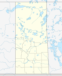
Höhe über Meeresspiegel 384 m
Fläche 373 km²[1]

Pinehouse Lake ist ein See im Zentrum der kanadischen Provinz Kanada. Die Wasserfläche beträgt 373 km², die Gesamtfläche einschließlich Inseln 404 km².[1] Der nördliche Teil des Sees wird vom Churchill River in östlicher Richtung durchflossen. Oberstrom und 60 km westlich liegt der Lac Île-à-la-Crosse. 80 km östlich des Pinehouse Lake liegt der Lac la Ronge.

Einzelnachweise

  1. a b Natural Resources Canada - The Atlas of Canada - Lakes

Wikimedia Foundation.

Игры ⚽ Поможем решить контрольную работу

Schlagen Sie auch in anderen Wörterbüchern nach:

  • Pinehouse Lake — Sp Páinhauso ẽžeras Ap Pinehouse Lake L Kanadoje (Saskačevano p ja) …   Pasaulio vietovardžiai. Internetinė duomenų bazė

  • Pinehouse Lake Airport — Infobox Airport name = Pinehouse Lake Airport IATA = ZPO ICAO = CZPO type = Public owner = operator = Ministry of Highways Infrastructure city served = location = Pinehouse Lake, Saskatchewan elevation f = 1,278 elevation m = 390 coordinates =… …   Wikipedia

  • Key Lake — is the site of the largest uranium mill in the world. It was initially developed as the site of open pit uranium mining at two sites: the Gaertner deposit and the Deilmann deposit. Production of original ore ceased in the late 1990s, and the Key… …   Wikipedia

  • Liste der IATA-Codes/Z — Diese Teilliste führt alle IATA Flughafen Codes auf, die mit „Z“ beginnen, und enthält Informationen zu den bezeichneten Verkehrsknotenpunkten. IATA Codes   A B C D E F G H …   Deutsch Wikipedia

  • List of lakes in Canada — Canada has an extremely large number of lakes. The number of lakes larger than three square kilometres is estimated at close to 31,191 by the Atlas of Canada. There is no official estimate of the number of smaller lakes. This list is at best… …   Wikipedia

  • Cree — Verbreitungsgebiet der Cree Gruppen in Kanada (nach einer Vorlage der Brock University Map Library) Die Cree (englisch, auch Kri, französisch: Les Cris) sind ein Indianervolk Nordamerikas. Ihr Stammesgebiet erstreckt sich von den Rocky Mountains… …   Deutsch Wikipedia

  • Liste der Seen in Kanada — Diese Liste enthält die 69 vom kanadischen Umweltministerium Natural Resources Canada als hauptsächliche Seen in Kanada bezeichneten Gewässer, die größer als 400 km² sind. Name Höhe Fläche Provinz Koordinaten Smallwood Reservoir 471 6527… …   Deutsch Wikipedia

  • Список озёр Канады — Эта статья содержит незавершённый перевод с английского языка. Вы можете помочь проекту, переведя её до конца. Это список озёр Канады. В Канаде очень большое число озёр …   Википедия

  • Missinipi Broadcasting Corporation — Broadcast area Saskatchewan Branding MBC Radio Frequency varies by location First air date 1985 …   Wikipedia

  • Saskatchewan Highway 914 — Infobox road state=SK type=Hwy route=914 alternate name= length km=275.00 length round=2 length ref=cite map|publisher=Google Maps|url=http://maps.google.com/maps?hl=en rlz=1T4ADBF enUS232US232 q=from:+HWY 914+%4055.234799,+ 106.789674+to:+HWY… …   Wikipedia

Share the article and excerpts

Direct link
Do a right-click on the link above
and select “Copy Link”