Playgreen Lake

Playgreen Lake
Playgreen Lake

Photo-request.svg

Bild gesucht 

BW

Geographische Lage Manitoba (Kanada)
Zuflüsse Nelson River
Abfluss Nelson River
Daten
Koordinaten 54° 1′ 59″ N, 98° 13′ 59″ W54.033055555556-98.233055555556217Koordinaten: 54° 1′ 59″ N, 98° 13′ 59″ W
Playgreen Lake (Manitoba)
Playgreen Lake
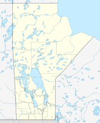
Höhe über Meeresspiegel 217 m
Fläche 652 km²[1]

Playgreen Lake ist ein See in der kanadischen Provinz Manitoba. Die Wasserfläche beträgt 652 km², die Gesamtfläche einschließlich Inseln 657 km².[1] Der See liegt am Abfluss des Winnipegsee und wird vom Nelson River durchflossen.

Einzelnachweise

  1. a b Natural Resources Canada - The Atlas of Canada - Lakes

Wikimedia Foundation.

Игры ⚽ Поможем написать реферат

Schlagen Sie auch in anderen Wörterbüchern nach:

  • Playgreen Lake — Infobox lake lake name = Playgreen Lake image lake = caption lake = image bathymetry = caption bathymetry = location = Manitoba coords = coord|53|52|N|98|05|W|region:CA type:waterbody|display=inline,title type = inflow = outflow = catchment =… …   Wikipedia

  • Playgreen Lake — Sp Plegrino ẽžeras Ap Playgreen Lake L Kanadoje (Manitoba) …   Pasaulio vietovardžiai. Internetinė duomenų bazė

  • Cross Lake — Bild gesucht  BW Geographische Lage Manitoba (Kanada) Zuflüsse …   Deutsch Wikipedia

  • Плейгрин — озеро Плейгрин англ. Playgreen Lake Координаты: Координаты …   Википедия

  • List of lakes in Canada — Canada has an extremely large number of lakes. The number of lakes larger than three square kilometres is estimated at close to 31,191 by the Atlas of Canada. There is no official estimate of the number of smaller lakes. This list is at best… …   Wikipedia

  • Cree — Verbreitungsgebiet der Cree Gruppen in Kanada (nach einer Vorlage der Brock University Map Library) Die Cree (englisch, auch Kri, französisch: Les Cris) sind ein Indianervolk Nordamerikas. Ihr Stammesgebiet erstreckt sich von den Rocky Mountains… …   Deutsch Wikipedia

  • Liste der Seen in Kanada — Diese Liste enthält die 69 vom kanadischen Umweltministerium Natural Resources Canada als hauptsächliche Seen in Kanada bezeichneten Gewässer, die größer als 400 km² sind. Name Höhe Fläche Provinz Koordinaten Smallwood Reservoir 471 6527… …   Deutsch Wikipedia

  • Nelson River — Coordinates: 57°5′5″N 92°30′8″W / 57.08472°N 92.50222°W / 57.08472; 92.50222 …   Wikipedia

  • Manitoba Provincial Road 373 — Provincial Road 373 Route information Maintained by Manitoba Infrastructure and Transportation Length: 170 km[1] (106 mi) Major junctions …   Wikipedia

  • Norway House, Manitoba — National Historic Site of Canada St …   Wikipedia

Share the article and excerpts

Direct link
Do a right-click on the link above
and select “Copy Link”