Ponte de Rubiães

Ponte de Rubiães
41.903942-8.626492

BWf1

Ponte de Rubiães
Querung von Rio Coura
Ort Portugal
Lage
Ponte de Rubiães (Portugal)
Ponte de Rubiães

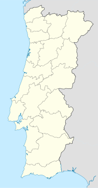
Die römische Brücke Ponte de Rubiães führt über den Rio Coura. Der Ort Rubiães liegt an der N201 von Valença nach Ponte de Lima an der Nordgrenze Portugals. Die Brücke besitzt einen größeren Mittelbogen und zwei kleine seitliche. Vor den Pfeilern sind schützend Strombrecher errichtet. Die Fahrbahn steigt zur Mitte hin an. Die alte Pflasterung ist teilweise, die Brüstung ist gut erhalten. Obwohl mehrfach erneuert, gilt die Brücke immer noch als römisch.

Literatur

  • T. G. Schattner: Archäologischer Wegweiser durch Portugal Mainz 1998

Weblinks


Wikimedia Foundation.

Игры ⚽ Нужно решить контрольную?

Schlagen Sie auch in anderen Wörterbüchern nach:

  • Ponte de Rubiães — The Rubiães Roman bridge is a bridge by the Rio Coura located in the parish of Rubiães and is by the Way of St. James.The bridge is was constructed in the 2nd century [Structurae|id=s0020359|title=Roman Bridge] and is located next to the parish… …   Wikipedia

  • Ponte Milvio — (Milvian Bridge) (Pons Milvius) Ponte Milvio over the Tiber Crosses Tiber Locale Rome, Italy …   Wikipedia

  • Rubiães — Infobox Parish pt official name = Rubiães image coat of arms = image location = Municipality = Paredes de Coura area total = 8.95 population total = 548 (2001) population density = 61.5 website = none footnotes =Rubiães is a Portuguese parish,… …   Wikipedia

  • Pons Cestius — (Pons Gratiani) The Pons Cestius in its modern form Official name Ponte Cestio Carries Tiber Island Trastevere …   Wikipedia

  • Pont du Gard — (Roman Aqueduct) * UNESCO World Heritage Site Country France …   Wikipedia

  • Severan Bridge — with the columns of Roman Emperor Lucius Septimius Severus and his second wife Julia Domna seen from the south. Official name Cendere Köprüsü Carries Road traffic an …   Wikipedia

  • Chesters Bridge — For the bridge across the Mississippi, see Chester Bridge. Coordinates: 55°01′30″N 2°08′17″W / 55.025°N 2.138°W / 55.025; 2.138 …   Wikipedia

  • Constantine's Bridge (Danube) — Constantine s Bridge Crosses Danube Locale Celeiu, Romania and Oescus, Bulgaria Total length 2,437 m (7,995 ft) Width 5.7 m (19 ft) …   Wikipedia

  • Constantine's Bridge (Mysia) — Constantine s Bridge Crosses Rhyndacus (Adırnas Çayı) Locale Mysia, Turkey Design Arch bridge Construction end After 258 AD …   Wikipedia

  • Aesepus Bridge — (Dove Bridge) Central piers (view from south) Carries Roman road to Kyzikos Crosses Aesepus (Gönen Çayı) …   Wikipedia

Share the article and excerpts

Direct link
Do a right-click on the link above
and select “Copy Link”