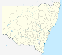
Rocklands Reservoir

Rocklands Reservoir
Rocklands Reservoir

Photo-request.svg

Bild gesucht 

BW

Lage: Victoria, Australien
Zuflüsse: Glenelg River, Holligan Creek, Muline Creek, Cattle Station Creek, Anderson Creek, Pendyle Pendyle Creek
Abflüsse: Glenelg River
Größere Orte am Ufer: Glenisla
Größere Orte in der Nähe: Balmoral
Rocklands Reservoir (New South Wales)
Rocklands Reservoir
Koordinaten 37° 15′ 8,2″ S, 142° 4′ 11,1″ O-37.25228729142.06976071Koordinaten: 37° 15′ 8,2″ S, 142° 4′ 11,1″ O
Daten zum Bauwerk
Daten zum Stausee
Höhe des Stauziels: 216 m
Wasseroberfläche bei Vollstau: 56 km²
Stauseelänge: 35 km
Stauseebreite: 5 km

Das Rocklands Reservoir ist ein Stausee im Südwesten des australischen Bundesstaates Victoria. Er liegt westlich der Grampians und südlich der Black Range.

Der Glenelg River und seine Nebenflüsse füllen den See. Das Wasser wird zur Bewässerung landwirtschaftlicher Flächen und für die Trinkwasserversorgung der umliegenden Kleinstädte benötigt.

Weblinks und Quellen


Wikimedia Foundation.

Игры ⚽ Поможем написать курсовую

Schlagen Sie auch in anderen Wörterbüchern nach:

  • Glenelg River (Victoria) — Glenelg River Bochara River Einzugsgebiet des Glenelg River DatenVorla …   Deutsch Wikipedia

  • List of dams and reservoirs in Australia — Dams and reservoirs in Australia is a link page for any dam or reservoir in Australia. Contents 1 Australian Capital Territory 2 New South Wales 2.1 Cancelled 2.2 Weir …   Wikipedia

  • Wimmera — Infobox Australian Place | type = region name = Wimmera state = vic caption = Mount Arapiles rises above the flat Wimmera plain lga = Shire of Buloke, Rural City of Horsham, Shire of Northern Grampians, Shire of West Wimmera, Shire of… …   Wikipedia

  • Glenelg River — ▪ river, Victoria, Australia       river in southwestern Victoria, Australia, rising on Mt. William in the Grampians east of Balmoral and flowing west and south to join its chief tributary, the Wannon River, at Casterton. It empties into… …   Universalium

  • List of localities in Victoria (Australia) — Map of Local Government Areas in Victoria This is a list of locality names and populated place names in the state of Victoria, Australia, outside the Melbourne metropolitan area. It is organised by region from the south west of the state to the… …   Wikipedia

  • Everglades National Park — IUCN Category Ib (Wilderness Area) …   Wikipedia

  • List of climbing areas — This is a list of articles about climbing areas and regions associated with climbing. This list is incomplete; you can help by expanding it. Table of Contents Africa | Asia | Australasia | Europe | North America | South America Africa South… …   Wikipedia

  • Neotropic ecozone — For the musical artist, see Neotropic (band). The Neotropic Ecozone In biogeography, the Neotropic or Neotropical zone is one of the eight terrestrial ecozones. This ecozone includes South and Central America, the Mexican lowlands, the Caribbean… …   Wikipedia

  • Shire of Kowree — Infobox Australian Place | type = lga name = Shire of Kowree state = vic region = area = 5379.41 est = 1862 seat = Edenhope pop = 3,710 (1992) [cite book|title=Victorian Year Book|author=Australian Bureau of Statistics, Victoria… …   Wikipedia

  • Everglades National Park — Parc national des Everglades Parc national des Everglades Catégorie II de la CMAP (Parc national) …   Wikipédia en Français

Share the article and excerpts

Direct link
Do a right-click on the link above
and select “Copy Link”