South Henik Lake

South Henik Lake
South Henik Lake

Photo-request.svg

Bild gesucht 

BW

Geographische Lage Nunavut (Kanada)
Zuflüsse Abfluss des North Henik Lake
Abfluss Tha-anne River
Daten
Koordinaten 61° 30′ N, 97° 20′ W61.499722222222-97.333055555556184Koordinaten: 61° 30′ N, 97° 20′ W
South Henik Lake (Kanada)
South Henik Lake
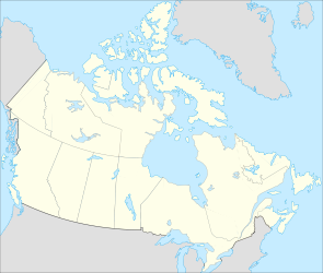
Höhe über Meeresspiegel 184 m
Fläche 513 km²[1]
Länge 65 kmf6
Breite 15 kmf7
Einzugsgebiet 7.140 km²[2]

South Henik Lake ist ein See im kanadischen Territorium Nunavut, 150 km westlich der Hudson Bay. Der See hat eine Fläche von 513 km².[1] Durch einen schmalen Isthmus ist der See vom nördlich gelegenen North Henik Lake getrennt. Über einen Abfluss im äußersten Osten der Landenge fließt das Wasser des North Henik Lake dem South Henik Lake zu. Am Südwestende des South Henik Lake entwässert der Tha-anne River den See und fließt in südlicher und später östlicher Richtung zur Hudson Bay.

Einzelnachweise

  1. a b Natural Resources Canada - The Atlas of Canada - Lakes
  2. R-ArcticNet

Wikimedia Foundation.

Игры ⚽ Поможем написать курсовую

Schlagen Sie auch in anderen Wörterbüchern nach:

  • Henik Lake — North Henik Lake Location Kivalliq Region, Nunavut Coordinates 61°43′59″N …   Wikipedia

  • Nettilling Lake — is in the southern part of the island, being the upper of the two visible lakes. The lower lake is Amadjuak Lake. Location Baffin Island, Nunavut Territory …   Wikipedia

  • Dubawnt Lake — Location Kivalliq Region, Nunavut Coordinates 63°4′0″N …   Wikipedia

  • Napaktulik Lake — Location Kivalliq Region, Nunavut Coordinates …   Wikipedia

  • List of lakes in Canada — Canada has an extremely large number of lakes. The number of lakes larger than three square kilometres is estimated at close to 31,191 by the Atlas of Canada. There is no official estimate of the number of smaller lakes. This list is at best… …   Wikipedia

  • Саут-Хеник — англ. South Henik Lake Координаты: Координаты …   Википедия

  • Liste der Seen in Kanada — Diese Liste enthält die 69 vom kanadischen Umweltministerium Natural Resources Canada als hauptsächliche Seen in Kanada bezeichneten Gewässer, die größer als 400 km² sind. Name Höhe Fläche Provinz Koordinaten Smallwood Reservoir 471 6527… …   Deutsch Wikipedia

  • Ihalmiut — The Ihalmiut ( People from Beyond )[1] or Ahiarmiut ( the Out of the Way Dwellers )[2][3][4] are a group of inland Inuit who lived along the banks of the Kazan River,[5] Ennadai Lake …   Wikipedia

  • Caribou Inuit — ethnic group group=Caribou Inuit poptime=3,000 popplace=Nunavut rels=Christianity, Shamanism langs=Inuktitut related=Copper InuitCaribou Inuit, Barren ground Caribou hunters, are bands of inland Inuit who lived west of Hudson Bay in northern… …   Wikipedia

  • Lacs du Canada — Liste des lacs du Canada Cet article tente de recenser la liste des lacs du Canada. Le Canada est réputé pour posséder un très grand nombre de lacs ; le nombre de lacs plus grand que 3 km² est estimé à 31 190 par l Atlas du Canada et il n… …   Wikipédia en Français

Share the article and excerpts

Direct link
Do a right-click on the link above
and select “Copy Link”