Taum Sauk Mountain

Taum Sauk Mountain
Taum Sauk Mountain
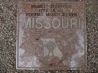
Die Granitplatte auf der Spitze der Erhebung markiert den Gipfel (Höhenangabe in Fuß)

Die Granitplatte auf der Spitze der Erhebung markiert den Gipfel (Höhenangabe in Fuß)

Höhe 540 m
Lage Iron County, Missouri
Gebirge Saint Francois Mountains
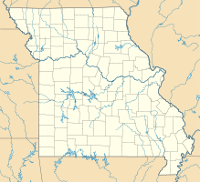
Geographische Lage 37° 34′ 13″ N, 90° 43′ 40″ W37.570277777778-90.727777777778540Koordinaten: 37° 34′ 13″ N, 90° 43′ 40″ W
Taum Sauk Mountain (Missouri)
Taum Sauk Mountain
Besonderheiten höchster Punkt Missouris
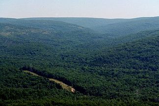
Taum Sauk Mountain am Horizont

Taum Sauk Mountain am Horizontbdep2

Der Taum Sauk Mountain ist mit seinen 540 Metern die höchste Erhebung des Iron County und des US-Bundesstaates Missouri. Er befindet sich in den Saint Francois Mountains und in der Nähe seines Gipfels steht ein Aussichtsturm, genannt Taum Sauk Lookout Tower. Auf der Spitze der Erhebung ist eine Granitplatte lokalisiert, welche den Zweck eines Gipfelkreuzes erfüllt. Unmittelbar neben dem Berg liegt das Pumpspeicherwerk Taum Sauk.

Weblinks


Wikimedia Foundation.

Игры ⚽ Нужно сделать НИР?

Schlagen Sie auch in anderen Wörterbüchern nach:

  • Taum Sauk Mountain — Taum Sauk redirects here. For pumped storage power plant, see Taum Sauk Hydroelectric Power Station. Taum Sauk Mountain Taum Sauk Mountain is part of a large parks and wilderness area …   Wikipedia

  • Taum Sauk Mountain — ▪ mountain, Missouri, United States       mountain in Iron county, southeastern Missouri, U.S., highest point (1,772 feet [540 m]) of the St. Francois Mountains and of the state. Centrepiece of Taum Sauk Mountain State Park, it is part of the… …   Universalium

  • Taum Sauk Mountain State Park — is located in the Saint Francois Mountains in Missouri (USA). It is centered around Taum Sauk Mountain, the highest point in the state.The park has a rustic campground, a paved trail to the highpoint, picnic facilities, and a lookout tower from… …   Wikipedia

  • Taum Sauk pumped storage plant — The remains of the Taum Sauk pumped storage plant are located in the St. Francois mountain region of the Missouri Ozarks approximately 90 miles (145 km) south of St. Louis near Lesterville, Missouri. The pumped storage hydroelectric plant,… …   Wikipedia

  • Mont Taum Sauk — Vue du mont Taum Sauk. Géographie Altitude 540 m Massif Montagnes Saint François …   Wikipédia en Français

  • Wildcat Mountain (Missouri) — Wildcat Mountain is a Convert|1770|ft|m|lk=on|adj=on summit in Iron County, Missouri, located Convert|1.4|mi|km|1|lk=on west of Taum Sauk Mountain, Missouri s highest peak. Wildcat Mountain s summit elevation is only two feet less than that of… …   Wikipedia

  • Ozark Trail (hiking trail) — Completed sections of the Ozark Trail …   Wikipedia

  • Saint Francois Mountains — The Saint Francois Mountains, a range located in southeast Missouri, is an outcrop of Precambrian igneous rock mountains rising over the Ozark Plateau. This range is one of the oldest exposures of igneous rock in North America. The range is often …   Wikipedia

  • Fredericktown, Missouri —   City   L …   Wikipedia

  • Iron County, Missouri — Infobox U.S. County county = Iron County state = Missouri founded year = 1857 founded date = February 17 seat wl = Ironton largest city wl = Ironton area total sq mi = 552 area total km2 = 1430 area land sq mi = 551 area land km2 = 1428 area… …   Wikipedia

Share the article and excerpts

Direct link
Do a right-click on the link above
and select “Copy Link”