Thomas Nunatak

Thomas Nunatak

f2

Thomas Nunatak

Photo-request.svg

Bild gesucht 

BWf1

Lage Antarktis
Gebirge Ellsworthgebirge
Geographische Lage 78° 59′ 0″ S, 87° 24′ 0″ W-78.983333333333-87.4Koordinaten: 78° 59′ 0″ S, 87° 24′ 0″ W
Thomas Nunatak (Antarktis)
Thomas Nunatak

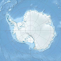
Thomas Nunatak ist ein Nunatak, der sich etwa 2 Seemeilen (3,7 km) nordwestlich des Hall Nunatak[1] und 17 Seemeilen (31 km) westlich der Camp Hills befindet. Die beiden isoliert liegenden Gipfel liegen entlang einer Eis-Steilstufe am Kopf des Minnesota-Gletschers im Ellsworthgebirge.[2]

Er wurde von einer Geologischen Expedition der University of Minnesota (1963/64) nach Hollie Thomas benannt, einem Helicopter Crew Chief des 62nd Transportion Corps Detachment der United States Army, der die Expedition unterstützte.[2]

Einzelnachweise

  1. Hall Nunatak (Englisch). Geographic Names Information System. United States Geological Survey. Abgerufen am 16. Juli 2010.
  2. a b Thomas Nunatak (Englisch). Geographic Names Information System. United States Geological Survey. Abgerufen am 16. Juli 2010.

Wikimedia Foundation.

Игры ⚽ Нужен реферат?

Schlagen Sie auch in anderen Wörterbüchern nach:

  • Nunatak Gongamur — Studio album by Thomas Köner Released 1990 Genre Ambient Length 48:23 …   Wikipedia

  • Nunatak Island — Geography Location Cumberland Sound Coordinates 66°28′N …   Wikipedia

  • Thomas Köner — (born 1965 in Bochum, Germany) is a multimedia artist whose main interest lies in combining visual and auditory experiences. He s been noted for his use of low frequencies [ [http://www.sleepbot.com/ambience/page/koner.html Thomas Koner ::… …   Wikipedia

  • Thomas Köner — Köner nach einem Auftritt im Goethe Institut Boston (2010) Thomas Köner (* 1965 in Bochum) ist ein deutscher Klang und Multimediakünstler. Köner kombiniert in seinen Werken oft visuelle mit auditiven Erfahrungen …   Deutsch Wikipedia

  • Hall Nunatak — f2 Hall Nunatak Bild gesucht  BWf1 Lage Antarktis …   Deutsch Wikipedia

  • Fusco Nunatak — f2 Fusco Nunatak Bild gesucht  BWf1 Lage Antarktis …   Deutsch Wikipedia

  • Dee Nunatak — (74°28′S 136°31′W / 74.467°S 136.517°W / 74.467; 136.517) is a rock nunatak which appears to be within the flow of Garfield Glacier, in the west part of McDonald Heights …   Wikipedia

  • Nelson Nunatak — (72°56′S 167°54′E / 72.933°S 167.9°E / 72.933; 167.9) is a mainly ice covered nunatak in the middle of Hand Glacier, in the Victory Mountains, Victoria Land …   Wikipedia

  • Oliver Nunatak — (84°5′S 66°8′W / 84.083°S 66.133°W / 84.083; 66.133) is one of the Rambo Nunataks, lying 2 nautical miles (3.7 km) south of Sowle Nunatak on the west side of Foundation Ice Stream, in the …   Wikipedia

  • Ackerman Nunatak — (coord|82|41|S|47|45|W|) is an isolated nunatak, 655 m, standing 6.5 miles (10 km) south southeast of Butler Rocks in northern Forrestal Range, Pensacola Mountains. Mapped by United States Geological Survey (USGS) from surveys and U.S. Navy air… …   Wikipedia

Share the article and excerpts

Direct link
Do a right-click on the link above
and select “Copy Link”