Vuaqava

Vuaqava

Vorlage:Infobox Insel/Wartung/Bild fehlt

Vuaqava
Gewässer Korosee
Inselgruppe Lau-Inseln
Geographische Lage 18° 51′ 57″ S, 178° 54′ 15″ W-18.865833333333-178.90416666667107Koordinaten: 18° 51′ 57″ S, 178° 54′ 15″ W
Vuaqava (Fidschi)
Vuaqava
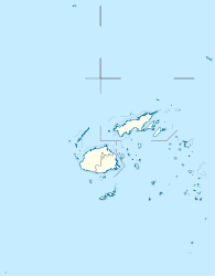
Länge 4,9 km
Breite 2 km
Fläche 7,7 km²
Höchste Erhebung 107 m
Einwohner (unbewohnt)

Vuaqava [βuaŋˈɡaβa], auch Vuanggava,[Anmerkung 1] ist eine Insel korallinen Ursprungs im Lau-Archipel im Pazifischen Ozean. Politisch gehört sie zur Eastern Division des Inselstaats Fidschi.

Inhaltsverzeichnis

Geographie

Vuaqava liegt in der Korosee im südlichen Bereich des Lau-Archipels, rund 5 km nordwestlich von Kabara. Die ovale Insel ist knapp 5 km lang, bis zu 2 km breit und weist eine Fläche von 7,7 km² auf.[1] Vuaqava stellt ein typisches Gehobenes Atoll dar, mit einer steilen Küste, dem einstigen Saumriff des Atolls, sowie einem tiefer im Landesinneren liegenden See, dem Rest der einstigen Lagune. Dieser See hat eine Fläche von etwa 1 km² und weist, da er unterirdisch mit dem Meer verbunden ist[2] eine hohe Salinität auf. Vuaqava erreicht eine Höhe von 107 m[1] über dem Meer und ist vollständig von einem Korallenriff umgeben. Die Insel ist unbewohnt, wird jedoch gelegentlich von Fischern von der benachbarten Insel Kabara aufgesucht.

Weblinks

Anmerkungen

  1. In Fidschi wird das "q" als "ngg" ausgesprochen, so dass auch diese Schreibweise oft auf Karten und in der Literatur zu finden ist

Einzelnachweise

  1. a b UNEP Islands Directory (englisch)
  2. Sailing Directions (enroute), Pub. 126, Pacific Ocean (PDF; englisch)

Wikimedia Foundation.

Игры ⚽ Нужен реферат?

Schlagen Sie auch in anderen Wörterbüchern nach:

  • Vuaqava — (pronounced|βuaŋgaβa) is an outlier to Kabara, 5 kilometers to the SSW, in Fiji s Southern Lau Group. Located at 18.83° South and 178.92° East, it occupies an area of 8.1 km2. This limestone island has a maximum altitude of 107 meters. The island …   Wikipedia

  • List of Fiji-related articles — NOTOC Articles (arranged alphabetically) about people, places, things, and concepts related to or originating from Fiji, include: 0 9 2007 Colonial Cup A Rodney ACRAMAN Adi Adi Da James AH KOY Air Fiji Air Pacific Air Pacific destinations Ahmed… …   Wikipedia

  • Mago Island — Coordinates: 17°26′S 179°09′W / 17.433°S 179.15°W / 17.433; 179.15 …   Wikipedia

  • Eastern Division, Fiji — The Eastern Division of Fiji is one of Fiji s four divisions. It consists of the four provinces, Kadavu, Lau, Lomaiviti and Rotuma.The capital of the division is Levuka, on the Ovalau island. Other islands in the division include Kadavu, Gau,… …   Wikipedia

  • Cicia —   Island   …   Wikipedia

  • Ogea Levu — (pronounced [oˈŋea ˈleβu]) is a coral island on a barrier reef in Fiji s Southern Lau archipelago. With an area of 13.3 square kilometers, it is situated at 19.18° South and 178.47° East, 10 kilometers east of Fulaga. It has a maximum altitude of …   Wikipedia

  • Ogea Driki — (pronounced [oˈŋea ˈndriki]) is a coral atoll (covering approximately 4 square kilometers) in Fiji s Southern Lau Group. It 2.7 kilometers south from Ogea Levu, 10 kilometers east of Fulaga. It is the farming and fishing ground for the Ogean… …   Wikipedia

  • Ono-i-Lau — NASA picture of Ono i Lau. Ono i Lau is a volcanic and coral island in Fiji s Lau archipelago. One of the southernmost of the Lau Islands, it is located at 20.80° South and 178.75° East, and occupies an area of 7.9 square kilometers. It has a… …   Wikipedia

  • Matuku Island — Matuku   Island   …   Wikipedia

  • Moala Islands — The Moala Islands are a subgroup of Fiji s Lau archipelago. Its three islands (Matuku, Moala, and Totoya) are located west of the Lau Islands proper, and were historically linked more closely with Bau Island and Viti Levu than with Lau. They we… …   Wikipedia

Share the article and excerpts

Direct link
Do a right-click on the link above
and select “Copy Link”