- Várzea Cova
-
Várzea Cova Wappen Karte 
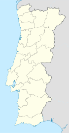

Basisdaten Region: Norte Unterregion: Ave Distrikt: Braga Concelho: Fafe Koordinaten: 41° 30′ N, 8° 4′ W41.506246-8.073313Koordinaten: 41° 30′ N, 8° 4′ W Einwohner: 447 (Stand: 2001) Fläche: 11,8 km² Bevölkerungsdichte: 38 Einwohner pro km² Várzea Cova ist eine Gemeinde im Norden Portugals.
Várzea Cova gehört zum Kreis Fafe im Distrikt Braga, besitzt eine Fläche von 11,8 km² und hat 447 Einwohner (Stand: 2001).[1]
Einzelnachweise
- ↑ Daten zu Várzea Cova. alea.pt, abgerufen am 26. Mai 2011 (englisch).
Weblinks
- Karte der Freguesia Várzea Cova beim Instituto Geográfico do Exército
- Information zu Várzea Cova. "Um vale fértil e aprazível.. fafeonline.com, abgerufen am 26. Mai 2011 (portugiesisch).

Aboim | Agrela | Antime | Ardegão | Armil | Arnozela | Arões (Santa Cristina) | Arões (São Romão) | Cepães | Estorãos | Fafe | Fareja | Felgueiras | Fornelos | Freitas | Golães | Gontim | Medelo | Monte | Moreira do Rei | Passos | Pedraído | Queimadela | Quinchães | Regadas | Revelhe | Ribeiros | São Gens | Seidões | Serafão | Silvares (São Clemente) | Silvares (São Martinho) | Travassós | Várzea Cova | Vila Cova | Vinhós


Wikimedia Foundation.