Waikari

Waikari

p1

Waikari
Waikari (Neuseeland)
Waikari
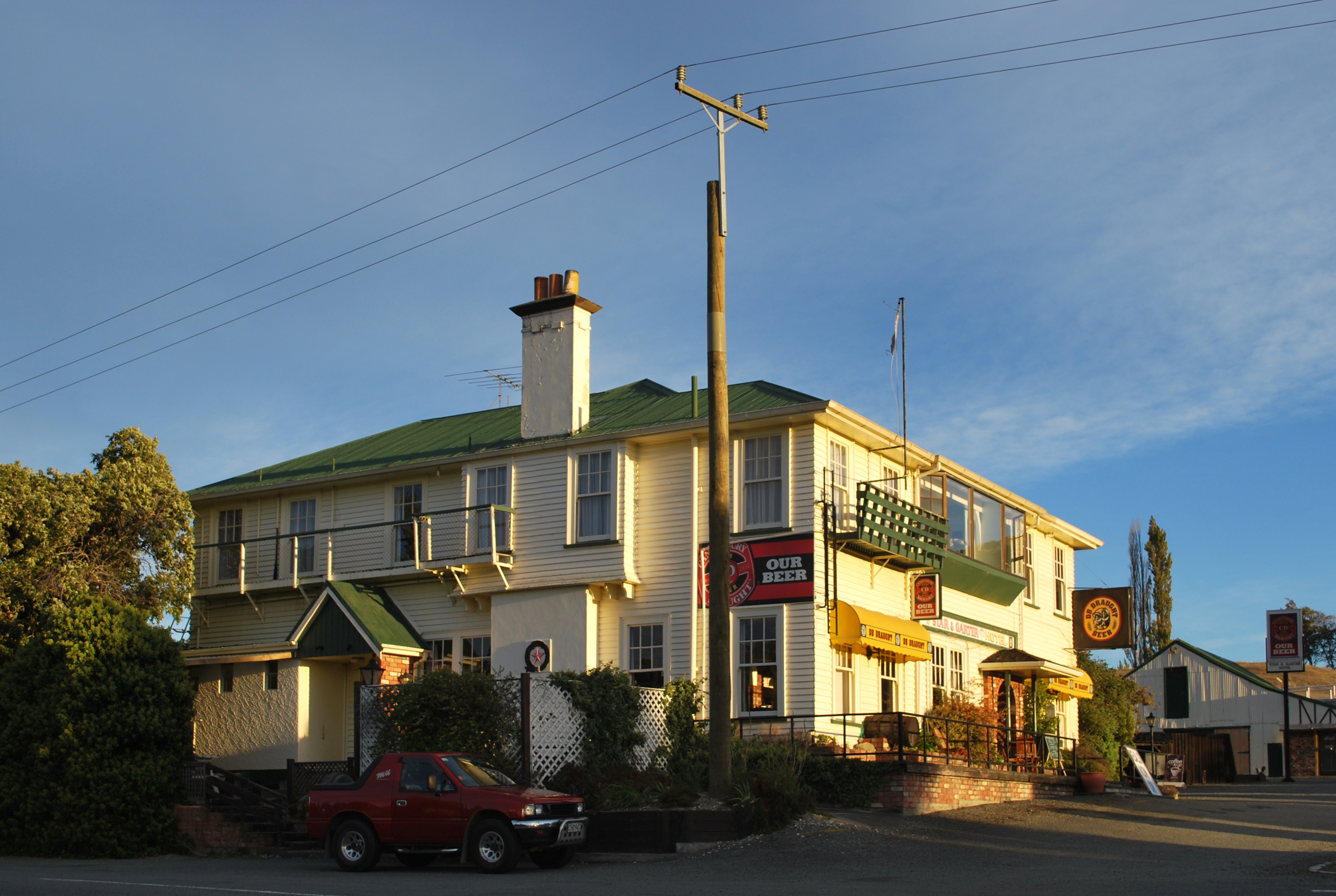
Koordinaten 42° 58′ S, 172° 41′ O-42.966666666667172.68333333333Koordinaten: 42° 58′ S, 172° 41′ O
Region Canterbury
Distrikt Hurunui-Distrikt
Das Star and Garter Hotel in Waikari

Waikari (māori für Graben [1]) ist eine kleine Ortschaft in der Region Canterbury auf der Südinsel Neuseelands. Sie liegt am State Highway 7 nahe dem Weka Pass.

Vom 6. April 1882 bis zum 15. Januar 1978 hatte der Ort durch den Waiau Branch Eisenbahnanschluss. Heute wird nur noch ein Teil der Strecke durch den Weka Pass als Weka Pass Railway für Touristenzüge betrieben, die zwischen Waipara and Waikari verkehren.

Er ist wirtschaftlich von der Kalksteinverarbeitung, Rinder- und Schafzucht geprägt.[1] Etwa 84% der Bewohner sind europäischer Abstammung.

Ein Denkmal im Ort erinnert an Charles Thomas Wilson Little, der sich 1918 während der Spanischen Grippe bis zu seinem eigenen Tod durch die Krankheit um seine Patienten bemühte. [1]

In der Nähe des Ortes befinden sich Felszeichnungen der Māori in der Weka Pass Reserve und das Pyramid Valley, ein bekannter Fundort von Fossilien des Moa.

Einzelnachweise

  1. a b c Das Neuseelandbuch, NZ Visitor Publications Ltd., Nelson 2003 S. 682 ISBN 1-877339-00-8

Weblinks


Wikimedia Foundation.

Игры ⚽ Поможем решить контрольную работу

Schlagen Sie auch in anderen Wörterbüchern nach:

  • Waikari — is a small town in the Canterbury region of New Zealand s South Island. It is located on State Highway 7 near the Weka Pass and was served by the Waiau Branch railway from 6 April 1882 until its closure on 15 January 1978. The section of the… …   Wikipedia

  • Weka Pass Railway — The Weka Pass Railway is a New Zealand heritage railway based in Waipara, North Canterbury. It is operated on a 12 km length of the former Waiau Branch railway between Waipara and Waikari. The railway is operated by an incorporated society whose… …   Wikipedia

  • Waiau Branch — The Waiau Branch was a branch line railway in the northern Canterbury region of New Zealand s South Island. Known as the Great Northern Railway for its first few decades of life, the Waiau Branch was seen as part of a main line north but was… …   Wikipedia

  • New Zealand State Highway 7 — State Highway 7 Route information Maintained by …   Wikipedia

  • Hawarden, New Zealand — Location map New Zealand label=Hawarden lat dir=S | lat deg=42 | lat min=56 lon dir=E | lon deg=172 | lon min=38 position=right width= 150 float=right caption=Hawarden is a small town in the Canterbury region of New Zealand s South Island. It is… …   Wikipedia

  • Medbury — …   Wikipedia

  • Pyramid Valley — is a limestone rock formation near Waikari in the North Canterbury region of New Zealand. It is lying 80 km north west of Christchurch. On the foot of that valley is a swamp which became notable in 1939 as New Zealand s largest paleontological… …   Wikipedia

  • Tane Norton — Infobox Rugby biography name = Tane Norton caption = birthname = Rangitane Will Norton birthyear = 1942 birthmonth = 03 birthday = 30 placeofbirth = Waikari, New Zealand dateofdeath = placeofdeath = height = height|m=1.83 weight =… …   Wikipedia

  • Pyramid Valley — 42.966666666667172.62666666667 Koordinaten: 42° 58′ 0″ S, 172° 37′ 36″ O …   Deutsch Wikipedia

  • Cheviot, New Zealand — Cheviot   town   …   Wikipedia

Share the article and excerpts

Direct link
Do a right-click on the link above
and select “Copy Link”