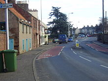
West Barns — is a small village in East Lothian, Scotland. It lies 2 miles west of Dunbar and approximately 28 miles east of Edinburgh. It is close to the John Muir Country Park and Belhaven Bay. It is home to the West Barns Inn and a John Deere Manufacturer … Wikipedia
Barns Green — infobox UK place country = England static static image caption= latitude= 51.03264 longitude= 0.39408 official name = Barns Green population = civil parish= Itchingfield shire district= Horsham shire county= West Sussex region= South East England … Wikipedia
West Sussex Football League — The West Sussex Football League is a football competition in England. It has a total of 12 divisions of which the highest, the Premier Division, sits at level 12 of the English football league system. It is a feeder to the Sussex County League… … Wikipedia
West Blatchington Windmill — which has been restored and is open to the public.History West Blatchington Windmill was built in the 1820s, first appearing on Greenwood s map of 1823. It was painted by John Constable in 1825. The mill is hexagonal in plan, whereas most smock… … Wikipedia
West Nile virus — Taxobox name = West Nile virus virus group = iv familia = Flaviviridae genus = Flavivirus species = West Nile virus Infobox Disease Name = West Nile Fever DiseasesDB = 30025 ICD10 = ICD10|A|92|3 MeshID = D014901West Nile virus (or WNV) is a virus … Wikipedia
West Hollywood, California — Infobox Settlement official name = West Hollywood, California settlement type = City nickname = WeHo or BoysTown motto = imagesize = image caption = image image blank emblem = imagesize = image caption = image image blank emblem = mapsize =… … Wikipedia
West Bromwich — Bromwich redirects here. For the mathematician, see Thomas John I Anson Bromwich Coordinates: 52°31′30″N 2°00′58″W / 52.525°N 2.016°W / 52.525; … Wikipedia
West Province (Cameroon) — Geobox|Province name = West Province country = Cameroon country capital = Bafoussam map caption = Location of West Province within Cameroon coordinates type = adm1st lat d = 5 |lat m = 30 |lat NS = N long d = 10 |long m = 30 |long EW = E area =… … Wikipedia
West Region (Cameroon) — Coordinates: 5°30′N 10°30′E / 5.5°N 10.5°E / 5.5; 10.5 … Wikipedia
West Pennine Moors — The West Pennine Moors is an area of approximately 90 square miles of moorland and reservoir scenery, located in Lancashire, between the towns of Chorley, Bolton, Horwich, Ramsbottom, Haslingden, Oswaldtwistle and Darwen. Notable architectural… … Wikipedia


 Hauptstraße von West Barns

