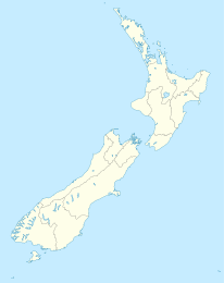
Whirinaki (Northland)

Whirinaki (Northland)
Whirinaki
Whirinaki (Neuseeland)
Whirinaki
Koordinaten 35° 28′ S, 173° 28′ O-35.466666666667173.46666666667Koordinaten: 35° 28′ S, 173° 28′ O
Einwohner 200
Region Northland
Distrikt Far North-Distrikt

Whirinaki ist eine Ortschaft südlich des Hokianga Harbour im Far North District der Region Northland auf der Nordinsel Neuseelands. Der Ortsname bedeutet "sich gegen eine Stütze lehnen". [1] Der State Highway 12 verläuft durch den Ort. Opononi liegt 6 km südwestlich. Die nächstgelegenen Orte sind Oue, Karuhiruhi und Opara im Norden und Nordwesten und Koutu und Motutoa im Westen. Der Whirinaki River durchquert den Ort und mündet kurz darauf in den Hokianga.[2]

Der Ort hat etwa 200 Einwohner, davon 90 % Māori. Ein großer Teil der Einwohner lebt auf Papakāinga-Land.[3]

Das Gebiet wurde von Te Roroa im Jahr 1810 oder 1811 während der Musketenkriege überfallen, dabei wurden alle Einwohner des in der Nähe gelegenen Dorfes Opara getötet.[4]

Bildung

Die Te Kura Kaupapa Maori o Te Tonga o Hokianga ist eine koedukative Grundschule für die 1.- 8. Klasse. Sie hatte 2009 ein decile rating von 2 und 56 Schüler.[5] Sie ist eine Kura Kaupapa Māori, eine Schule die vollständig in der Sprache der Māori lehrt. In der frühen Mitte des 20. Jahrhunderts hatte es bereits eine Eingeborenenschule im Ort gegeben, die Whirinaki Native School.[6]

Einzelnachweise

  1. http://www.teara.govt.nz/NewZealanders/MaoriNewZealanders/NgaPuhi/3/en Ngā Puhi - Ancestors ,Te Ara Encyclopedia of New Zealand]
  2. New Zealand Travel Atlas, Wise Maps Auckland ISBN 0-908794-47-9
  3. Nga Mahi Hapai – Whirinaki Waterline (Office for the Community and Voluntary Sector)
  4. Stephenson Percy Smith: Further Wars on the Border-Land. In: Maori Wars of the Nineteenth Century, S. S. 52 1910
  5. Te Kete Ipurangi - Te Kura Kaupapa Maori o Te Tonga o Hokia. Ministry of Education. Abgerufen am 8. März 2011.
  6. Raeburn Lange: May the People Live: a history of Maori health development, 1900-1920, S. S. 76 1999, ISBN 1869402146

Wikimedia Foundation.

Игры ⚽ Нужно сделать НИР?

Schlagen Sie auch in anderen Wörterbüchern nach:

  • Whirinaki, Northland — Location map North Island label=Whirinaki lat dir=S | lat deg=35 | lat min=28 lon dir=E | lon deg=173 | lon min=28 position=right width= 150 float=right caption=Whirinaki is a locality in the south Hokianga, in Northland, New Zealand. The name… …   Wikipedia

  • Whirinaki — bezeichnet in Neuseeland einen Ort in der Region Northland, Whirinaki (Northland) einen Ort in der Region Hawke s Bay, Whirinaki (Hawke s Bay) den Whirinaki Forest Park Diese Seite ist eine Begriffsklärung zur Unterscheidung mehrerer …   Deutsch Wikipedia

  • Whirinaki — may refer to:* Whirinaki, Northland * Whirinaki, Hawke s Bay * Whirinaki Forest Park …   Wikipedia

  • Northland Rugby Union — Northland Rugby Football Union Nickname(s) Taniwha, Cambridge Blues Founded 1920 Region Northland Ground(s) Okara Park, Whangar …   Wikipedia

  • Hokianga — Image of the Hokianga generated by NASA s World Wind program Hokianga (or the Hokianga) is an area surrounding the Hokianga Harbour, also known as The Hokianga River, a long estuarine drowned valley on the west coast in the north of the North… …   Wikipedia

  • Opononi — Opononi …   Wikipedia

  • Conservation parks of New Zealand — Conservation park is a type of specially protected status for land held by the Crown for conservation purposes.[1] In New Zealand this land is administered by the Department of Conservation (DoC) and was set up under the Conservation Act 1987. As …   Wikipedia

  • National parks of New Zealand — National Park, New Zealand is the name of a village and railway station near Tongariro National Park. Map of New Zealand with the national parks marked in green. The national parks of New Zealand are 14 protected areas administered by the… …   Wikipedia

  • Hokianga — NASA World Wind Satelliten Aufnahme des Hokianga Harbour Der Hokianga Harbour, der auch als Hokianga River bezeichnet wird, ist ein Naturhafen an der Westküste der nördlichen neuseeländischen Nordinsel. Der etwas weiter gefasste Begriff The… …   Deutsch Wikipedia

  • Hokianga Harbour — NASA World Wind Satelliten Aufnahme des Hokianga Harbour Der Hokianga Harbour, der auch als Hokianga River bezeichnet wird, ist ein Naturhafen an der Westküste der nördlichen neuseeländischen Nordinsel. Der etwas weiter gefasste Begriff The… …   Deutsch Wikipedia

Share the article and excerpts

Direct link
Do a right-click on the link above
and select “Copy Link”