Whitetop Mountain

Whitetop Mountain
Whitetop Mountain

Photo-request.svg

Bild gesucht 

BWf1

Höhe 1.682 m
Lage Virginia, Vereinigte Staaten
Gebirge Blue Ridge Mountains
Dominanz 5,93 km → Mount Rogers
Schartenhöhe 317 mfd2
Geographische Lage 36° 38′ 34″ N, 81° 36′ 28″ W36.642777777778-81.6077777777781682Koordinaten: 36° 38′ 34″ N, 81° 36′ 28″ W
Whitetop Mountain (Virginia)
Whitetop Mountain
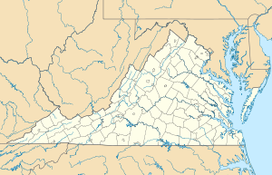
Erstbesteigung Unbekannt
Besonderheiten Zweithöchster Berg in Virginia

Whitetop Mountain ist der zweithöchste Berg im US-Bundesstaat Virginia. Er gehört zur Gebirgskette der Blue Ridge Mountains. Der Berg hat eine Höhe von 1682 m über dem mittleren Meeresspiegel. Er befindet sich auf der Schnittstelle von Grayson County, Smyth County und Washington County. Er lässt sich sehr leicht über ausgewiesene Wanderwege erreichen.

Von 1932 bis 1939 fand auf dem Berg das White Top Folk Festival statt.

Weblinks


Wikimedia Foundation.

Игры ⚽ Поможем решить контрольную работу

Schlagen Sie auch in anderen Wörterbüchern nach:

  • Whitetop Mountain — Infobox Mountain Name = Whitetop Mountain Photo = Whitetop.jpg Caption = View from Whitetop of Buzzard Rock and Beech Mountain. Elevation = 5,520 ft (1,682 m) Location = Virginia, USA Range = Appalachian Mountains, Blue Ridge Mountains Prominence …   Wikipedia

  • Flattop Mountain — and Flat Top Mountain may refer to*in the United States:NameStateCountyCoordinatesUSGS 7.5 MapFlattop Mountain (Anchorage, Alaska)AKMunicipality of Anchoragecoord|61|05|26|N|149|39|55|W|Anchorage A 8 SEFlat Top Mountain (Sitka City and Borough,… …   Wikipedia

  • Mount Rogers — For other mountains by this name, see Mount Rogers (disambiguation). Mount Rogers Mount Rogers in winter Elevation …   Wikipedia

  • List of mountains of the United States — This list of mountains of the United States includes significant mountain peaks and high points located in the United States of America arranged alphabetically by state, district, or territory.ignificant mountain peaks and high points Alabama… …   Wikipedia

  • Mouth of Wilson, Virginia — Mouth of Wilson is an unincorporated community, in Grayson County in the U.S. state of Virginia, just north of the North Carolina state line. The community lies in the Appalachian Mountains on the western banks of the New River, where the Big… …   Wikipedia

  • Appalachian Mountains — Appalachian redirects here. For the region, see Appalachia. Appalachian Mountains Appalachians Range …   Wikipedia

  • George Washington and Jefferson National Forests — Coordinates: 38°30′0″N 79°0′0″W / 38.5°N 79°W / 38.5; 79 …   Wikipedia

  • White Top — For the mountain in Grayson County, Virginia, see Whitetop Mountain. For the plant, see Austrodanthonia caespitosa. Coordinates: 38°37′28″N 79°52′36″W /  …   Wikipedia

  • Johnny Gentry — is a bluegrass musician from Mountain Park, North Carolina. He has performed with a wide variety of groups including the White Top Mountain Band [ [http://whitetopmountainband.tripod.com White Top Mountain Band website] ] . He is featured on… …   Wikipedia

  • Lilium grayi — – Illustration von Joseph Dalton Hooker 1892 Systematik Monokotyledonen Ordnung …   Deutsch Wikipedia

Share the article and excerpts

Direct link
Do a right-click on the link above
and select “Copy Link”