- Culasi
-
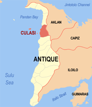
Municipality of Culasi Lage von Culasi in der Provinz Antique 
Basisdaten Bezirk: Western Visayas Provinz: Antique Barangays: 44 Distrikt: 1. Distrikt von Antique PSGC: 060606000 Einkommensklasse: 3. Einkommensklasse Haushalte: 6396 Zensus 1. Mai 2000Einwohnerzahl: 37.100 Zensus 1. August 2007Koordinaten: 11° 25′ N, 122° 4′ O11.41542122.0677Koordinaten: 11° 25′ N, 122° 4′ O Geographische Lage auf den Philippinen 

Culasi Culasi ist eine philippinische Stadtgemeinde in der Provinz Antique. Sie hat 32.998 Einwohner in 6396 Haushalten (Zensus: 1. Mai 2000).
Baranggays
Culasi ist politisch unterteilt in 44 Baranggays.
- Alojipan
- Bagacay
- Balac-balac
- Magsaysay (Balua)
- Batbatan Island
- Batonan Norte
- Batonan Sur
- Bita
- Bitadton Norte
- Bitadton Sur
- Buenavista
- Buhi
- Camancijan
- Caridad
- Carit-an
- Condes
- Esperanza
- Fe
- Flores
- Jalandoni
- Janlagasi
- Lamputong
- Lipata
- Malacañang
- Malalison Island
- Maniguin Island
- Naba
- Osorio
- Paningayan
- Centro Poblacion
- Centro Norte (Pob.)
- Centro Sur (Pob.)
- Salde
- San Antonio
- San Gregorio
- San Juan
- San Luis
- San Pascual
- San Vicente
- Simbola
- Tigbobolo
- Tinabusan
- Tomao
- Valderama
Schlagen Sie auch in anderen Wörterbüchern nach:
Culasi — 1 Original name in latin Culasi Name in other language Culasi State code PH Continent/City Asia/Manila longitude 11.42721 latitude 122.05601 altitude 5 Population 4385 Date 2011 07 31 2 Original name in latin Culasi Name in other language Culasi… … Cities with a population over 1000 database
Culasi — 11°24′56″N 122°04′04″E / 11.41556, 122.06778 … Wikipédia en Français
Culasi, Antique — Map of Antique showing the location of Culasi Culasi is a third class municipality in the province of Antique, Philippines. Located at the northern portion of the sea horse shaped province. It is bounded on the north by the Municipality of… … Wikipedia
Antique (province) — Infobox Philippine province name = Antique sealfile = Ph seal antique.png region = Western Visayas (Region VI) capital = San Jose founded = mdash; pop2000 = 471,088 pop2000rank = 26th smallest popden2000 = 187 popden2000rank = 46th highest… … Wikipedia
PH-ANT — Lage der Provinz Antique Antique ist eine Provinz auf der Insel Panay, die zu dem Inselstaat der Philippinen gehört. Antique hat eine Fläche von 2.522 km² und ca. 431.700 Einwohner. Die Hauptstadt der Provinz ist San Jose de Buenavista.… … Deutsch Wikipedia
Roxas City — Lungsod ng Roxas Ciudad sang Roxas Lage von Roxas City in der Provinz Capiz Basisdaten Bezirk … Deutsch Wikipedia
Maniguin Island Lighthouse — Maniguin Island Lighthouse … Wikipedia
List of hospitals in the Philippines — This is a partial list of hospitals in the Philippines.LuzonILOCOS NORTE*Mariano Marcos Memorial Hospital Batac CityBaguio City*Baguio General Hospital *Saint Louis University Hospital of the Secret Heart *BCU Sto. Nino Jesus Hospital foundation… … Wikipedia
Roxas City — Infobox Philippine city infoboxtitle = Roxas City | sealfile = Ph seal capiz roxas.png locatormapfile = Ph locator capiz roxas.png caption = Map of Capiz showing the location of Roxas City region = Western Visayas (Region VI) province = Capiz… … Wikipedia
Palanan, Isabela — Palanan is a remote 3rd class municipality in the province of Isabela, Philippines. According to the 2000 census, it has a population of 15,317 people in 2,837 households.It was in Palanan that one of the final chapters of the Philippine American … Wikipedia
Culasi

18+
© Academic, 2000-2026
- Kontaktieren Sie uns: Unterstützung, Werbung
Wörterbücher Export, schritte mit PHP, Joomla, Drupal, WordPress, MODx.