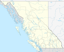
Digby Island

Digby Island

Vorlage:Infobox Insel/Wartung/Bild fehltVorlage:Infobox Insel/Wartung/Fläche fehltVorlage:Infobox Insel/Wartung/Höhe fehlt

Digby Island
Gewässer Pazifischer Ozean
Geographische Lage 54° 16′ 57,53″ N, 130° 25′ 41,67″ W54.282648-130.428241Koordinaten: 54° 16′ 57,53″ N, 130° 25′ 41,67″ W
Digby Island (British Columbia)
Digby Island

Digby Island ist eine Insel in der kanadischen Provinz British Columbia.

Inhaltsverzeichnis

Geschichte

Es gibt eine Fülle von einheimischen Geschichten in diesem Gebiet und es wurden viele archäologische Untersuchungen im Laufe der Jahre durchgeführt. In der Bucht Dodge Cove befindet sich Kanagatsiyot, ein Dorf der Tsimshian, einer First-Nations-Naturvölkergruppe in Kanada und Nordamerika mit einer Tradition von einigen Tausend Jahren.

Der Name der Insel

Die Insel wurde 1867 nach Henry Almarus Digby, einem 2. Leutnant der Royal Navy auf der HMS Malacca, benannt.[1] 1912 wurde hier eine moderne Marine-Station und eine herrliche Residenz mit Personal-Viertel, Bürogebäude und verschiedenen Geschäften errichtet. Diese Gebäude stehen heute noch und sind privates Eigentum.

Besiedlung in der Neuzeit

Die erste neuzeitliche Besiedlung der Insel fand statt durch norwegische Fischer Anfang des 20. Jahrhunderts. Sie nannten ihr Dorf „Norwegian Village“.

Wirtschaftliche Entwicklung

1912 wurde auf der Insel ein heute nur noch in Ruinen vorhandenes Krankenhaus erbaut. Nach dem Bootsbau, der hier von 1919 bis 1981 Arbeitsplätze schuf, war nach 1938 der Anbau von Erdbeeren ein zusätzlicher Wirtschaftsfaktor neben der Fischerei. Der kanadische Fernsehsender CBC/Radio-Canada hat hier 1943 auf dem „CBC-Hill“ eine Verstärker-Station errichtet. In den frühen sechziger Jahren hat die kanadische Regierung den Bau des Prince Rupert Airport beschlossen. Der Flughafen wurde 1961 eröffnet.

Zukunftspläne

Es gibt Pläne für den Bau einer massiven Brücke zwischen Digby Island und Prince Rupert. Ob diese Brücke allerdings jemals gebaut wird, ist fraglich.


Weblinks

Einzelnachweise

  1. BCGNIS Geographical Name Details

Wikimedia Foundation.

Игры ⚽ Нужно сделать НИР?

Schlagen Sie auch in anderen Wörterbüchern nach:

  • Digby Island — The community of Dodge Cove. Digby Island is a small island off the coast of Prince Rupert, British Columbia. The island is home to the Prince Rupert Airport and the small community of Dodge Cove. The island is named for Henry A. Digby, an… …   Wikipedia

  • Digby Island — Sp Digbio salà Ap Digby Island L Ramiajame vand., Kanada (Britų Kolumbija) …   Pasaulio vietovardžiai. Internetinė duomenų bazė

  • Prince Rupert/Digby Island Water Aerodrome — For other uses, see Prince Rupert (disambiguation). Prince Rupert/Digby Island Water Aerodrome IATA: none – ICAO: none – TC LID: CAN6 Summary Airport type Public …   Wikipedia

  • Digby County, Nova Scotia — Digby County   County   Location of Digby County, Nova Scotia Coordinates …   Wikipedia

  • Digby Neck — is a Canadian peninsula extending into the Bay of Fundy in Digby County, Nova Scotia …   Wikipedia

  • Digby, Nova Scotia (municipal district) — Digby   Municipal district   Location of Digby Municipal District …   Wikipedia

  • Digby, Nova Scotia — Digby   Town   Digby Harbour …   Wikipedia

  • Digby (Nova Scotia) — Digby Lage in Nova Scotia …   Deutsch Wikipedia

  • Digby (blogger) — Digby is the pseudonym of liberal political blogger Heather Parton from Santa Monica, California who founded the blog Hullabaloo. She has been called one of the leading and most admired commentators of the progressive blogosphere.[1] Digby began… …   Wikipedia

  • Digby Jones, Baron Jones of Birmingham — The Right Honourable The Lord Jones of Birmingham Kt Minister of State for Trade and Investment In office 29 June 2007 – 3 October 2008 Prime Minister …   Wikipedia

Share the article and excerpts

Direct link
Do a right-click on the link above
and select “Copy Link”