- Ahititi
-
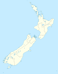
Ahititi Koordinaten 38° 52′ S, 174° 36′ O-38.861388888889174.605Koordinaten: 38° 52′ S, 174° 36′ O Region Taranaki Distrikt New Plymouth Ahititi ist ein kleiner Ort in der Region Taranaki in Neuseeland. Der State Highway 3 verläuft durch den Ort. Mokau liegt 23 km im Norden, Mimi 26 km südwestlich und Kotare 16 km östlich. Der Tongaporutu River fließt im Nordosten an Ahititi vorbei und mündet etwa 5 km nordwestlich bei Tongaporutu in die North Taranaki Bight.[1][2] Der Ortsname bedeutet in der Sprache der Maori "Kochfeuer" (ahi) für "Sturmvögel" (titi).[3]
Bildung
Die Schule von Ahititi ist eine koedukative Grundschule für die ersten acht Schuljahre mit einem decile rating von 5 und 43 Schülern (01/2009). [4]
Literatur
- Tongaporutu Ahititi Okau centennial booklet, 1897-1997, Ahititi/New Plymouth Centennial Committee/Aries Print 1997
- Brian E. Gray: The Tongaporutu River Valley : a history of the combined districts of Tongaporutu, Ahititi, Okau, Kotare, Rerekapa, Inglewood, Tongaporutu Historical Committee 2000, ISBN 0-473-07216-5
- Parochial District of Saint Peter-by-the-Sea, Mokau: come unto me, Mokau ca.1956
Einzelnachweise
- ↑ Peter Dowling (editor): Reed New Zealand Atlas, S. map 26, Reed Books 2004, ISBN 0-7900-0952-8
- ↑ Roger Smith, GeographX: The Geographic Atlas of New Zealand, S. map 75, Robbie Burton 2005, ISBN 1-877333-20-4
- ↑ Errol Brathwaite: The Companion Guide to the North Island of New Zealand, S. p 158 1970
- ↑ Jubilees & reunions: Ahititi, Tongaporutu, Okau Schools and District Reunion. In: Education Gazette New Zealand. 75, Nr. 22, 16. Dezember 1996.
Kategorien:- Ort in der Region Taranaki
- Taranaki (Region)
Wikimedia Foundation.

