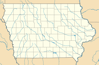
Island Lake Township, Lyon County, Minnesota — Infobox Settlement official name = Island Lake Township, Minnesota settlement type = Township nickname = motto = imagesize = image caption = image |pushpin pushpin label position =left pushpin map caption =Location within the state of Minnesota… … Wikipedia
Island Lake Township, Mahnomen County, Minnesota — Infobox Settlement official name = Island Lake Township, Minnesota settlement type = Township nickname = motto = imagesize = image caption = image |pushpin pushpin label position =left pushpin map caption =Location within the state of Minnesota… … Wikipedia
Rattlesnake Island (Lake Erie) — For other places with the same name, see Rattlesnake Island. Rattlesnake Island is an 85 acre island located on Lake Erie near Put In Bay, 11 miles northeast of Port Clinton, Ohio. It is one of several islands known as the Lake Erie Islands. The… … Wikipedia
Lake Nipigon — Location Ontario Coordinates … Wikipedia
Turtle Island (Lake Erie) — Turtle Island is a small island in Lake Erie that defines part of the boundary between the U.S. states of Ohio and Michigan. The island lies at coord|41|45|9|N|83|23|28|W|, just outside of the Maumee Bay about five miles (8 km) northeast of the… … Wikipedia
Beaver Island (Lake Michigan) — Beaver Island is the largest island in Lake Michigan and part of the Beaver Island archipelago. Once home to a unique American monarchy, the island is now a popular tourist and vacation destination.Beaver is thirteen miles (19 km) long, three to… … Wikipedia
Lake Itasca — The source of the Mississippi River on the edge of Lake Itasca Location Itasca State Park, Clearwater County, Minnesota, USA … Wikipedia
Lake Champlain — For ships named after the lake, see USS Lake Champlain. Lake Champlain Lake Champlain near Burlington in early twilight Location New … Wikipedia
Lake Balkhash — Not to be confused with Lake Baikal. Lake Balkhash Балқаш Көлі Озеро Балхаш View from Space, April 1991 Location Kazakhstan Coordinates … Wikipedia
Lake Monger — This article is about Lake Monger in suburban Perth. It should not be confused with Mongers Lake in east Perenjori in the Mid West region of Western Australia which is part of the major inland drainage system in that region and is 184 km long and … Wikipedia


