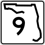
Florida State Road 9

Florida State Road 9
Straßenschild der Florida State Route 9
Basisdaten
Gesamtlänge:  14 mi/22 km
Eröffnung:  1946
Bundesstaat:  Florida
Anfangspunkt:  US 1 in Miami
Endpunkt:  Straßenschild der I-95 I-95, US 441 bei Golden Glades
County:  Miami-Dade County

Die Florida State Route 9 (kurz FL 9) ist eine State Route im US-Bundesstaat Florida, die in Nord-Süd-Richtung verläuft.

Die State Route beginnt am U.S. Highway 1 im Zentrum von Miami und endet nach 22 Kilometern nahe Golden Glades am Golden Glades Interchange, einem Kreuz zwischen der Interstate 95, dem U.S. Highway 441 und dem Florida’s Turnpike.

Verlauf

Die Florida State Route 9 verläuft zunächst in nördlicher Richtung als NW 27th Avenue und trifft in der NW 22nd Street auf die Florida State Route 972, in der NW 8th Street auf den U.S. Highway 41 sowie in der W Flagler Street auf die Florida State Route 968. Am Dolphin Expressway kreuzt die Straße die als mautpflichtiger Freeway ausgebaute Florida State Route 836. Nach der Kreuzung mit dem U.S. Highway 27 trifft sie mit der Florida State Route 112 auf eine weitere mautpflichtige Straße. Ab der Abzweigung der Florida State Route 817 in Opa-locka verläuft die Straße in nordwestlicher Richtung und endet schließlich am Golden Glades Interchange.

Siehe auch


Wikimedia Foundation.

Игры ⚽ Поможем решить контрольную работу

Schlagen Sie auch in anderen Wörterbüchern nach:

  • Florida State Road 50 — State Road 50 Major highways in Florida with FL 50 in red. Route information …   Wikipedia

  • Florida State Road 44 — State Road 44 Route information Maintained by FDOT Length: 115.246 mi[1] …   Wikipedia

  • Florida State Road 40 — State Road 40 Route information Maintained by FDOT Length: 91.7 mi[ …   Wikipedia

  • Florida State Road 39 — State Road 39 Route information Maintained by FDOT Length: 19.91 mi[1] …   Wikipedia

  • Florida State Road 94 — State Road 94 Kendall Drive South 88th Street Route information Maintained by FDOT Length …   Wikipedia

  • Florida State Road 48 — State Road 48 Route information Maintained by FDOT …   Wikipedia

  • Florida State Road 76 — State Road 76 Kanner Highway Route information Maintained by FDOT Length: 31.5 mi …   Wikipedia

  • Florida State Road 54 — State Road 54 Route information Maintained by FDOT Existed: 1945 renumbering ( …   Wikipedia

  • Florida State Road 24 — FL 24 redirects here. For the congressional district, see Florida s 24th congressional district. State Road 24 Route information Maintained by FDOT L …   Wikipedia

  • Florida State Road 15 — FL 15 redirects here. For the congressional district, see Florida s 15th congressional district. State Road 15 Route information Maintained by FDOT …   Wikipedia

  • Florida State Road 4 — FL 4 redirects here. For the congressional district, see Florida s 4th congressional district. State Road 4 Route information Maintained by FDOT Length …   Wikipedia

Share the article and excerpts

Direct link
Do a right-click on the link above
and select “Copy Link”