- Aldeia do Mato
-
Aldeia do Mato Wappen Karte 

Basisdaten Region: Centro Unterregion: Médio Tejo Distrikt: Santarém Concelho: Abrantes Koordinaten: 39° 33′ N, 8° 16′ W39.54233-8.27159Koordinaten: 39° 33′ N, 8° 16′ W Einwohner: 560 (Stand: 2001) Fläche: 28,9 km² Bevölkerungsdichte: 19 Einwohner pro km² Aldeia do Mato ist eine Gemeinde (Freguesia) in Portugal.
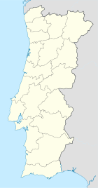
 Lage von Aldeia do Mato im Kreis
Aldeia do Mato gehört zum Kreis Abrantes im Distrikt Santarém, besitzt eine Fläche von 28.9 km² und hat 560 Einwohner (2001).[1]
Einzelnachweise
- ↑ Daten zu Aldeia do Mato (en). alea.pt. Abgerufen am 30. April 2011.
Weblinks
- Karte der Freguesia Aldeia do Mato beim Instituto Geográfico do Exército
 Freguesias im Concelho Abrantes
Aldeia do Mato | Alferrarede | Alvega | Bemposta | Carvalhal | Concavada | Fontes | Martinchel | Mouriscas | Pego | Rio de Moinhos | Rossio ao Sul do Tejo | São Facundo | São João | São Miguel do Rio Torto | São Vicente | Souto | Tramagal | Vale das Mós
Wikimedia Foundation.
Schlagen Sie auch in anderen Wörterbüchern nach:
Aldeia do Mato — Freguesia de Portugal Entidad Freguesia • País … Wikipedia Español
Aldeia do Mato — Infobox Parish pt official name = Aldeia do Mato image coat of arms = Municipality = Abrantes area total = 31.40 population total = 560 (2001) population density = 18 website = none footnotes =Aldeia do Mato is a Portuguese parish, located in the … Wikipedia
List of postal codes in Portugal — Aveiro districtMealhada municipality*3050 Antes *3050 Barcouço *3050 Casal Comba *3050 Luso *3050 Mealhada *3050 Pampilhosa *3050 Vacariça *3050 Ventosa do BairroMurtosa municipality*3870 Bunheiro *3870 Monte *3870 Murtosa *3870 TorreiraOliveira… … Wikipedia
Freguesias de Portugal — Anexo:Freguesias de Portugal Saltar a navegación, búsqueda Contenido 1 A 1.1 Abrantes 1.2 Águeda 1.3 … Wikipedia Español
Anexo:Freguesias de Portugal — Contenido 1 A 1.1 Abrantes 1.2 Águeda 1.3 Aguiar da Beira 1.4 … Wikipedia Español
Районы округа Сантарен — … Википедия
Алдейя-ду-Мату — Район Алдейя ду Мату Aldeia do Mato Страна ПортугалияПортугалия … Википедия
Alvega — Wappen Karte … Deutsch Wikipedia
Abrantes — Infobox Municipality pt official name = Abrantes image coat of arms = ABT.png Region = Centro Subregion = Médio Tejo District = Santarém Mayor name = Nélson Carvalho Mayor party = Socialist area total = 714.7 population total = 41,326 population… … Wikipedia
Vale Formoso — is a parish in the municipality of Covilhã, (Portugal).It changed its name on August 6, 1944, having previously been called Aldeia do Mato … Wikipedia
Aldeia do Mato


18+
© Academic, 2000-2026
- Kontaktieren Sie uns: Unterstützung, Werbung
Wörterbücher Export, schritte mit PHP, Joomla, Drupal, WordPress, MODx.