Gunung Tahan

Gunung Tahan
Gunung Tahan

Photo-request.svg

Bild gesucht 

BWf1

Höhe 2.187 m
Lage Bundesstaat Pahang, Malaysia
Gebirge Perakkette
Geographische Lage 4° 38′ 0″ N, 102° 14′ 0″ O4.6333333333333102.233333333332187Koordinaten: 4° 38′ 0″ N, 102° 14′ 0″ O
Gunung Tahan (Malaysia)
Gunung Tahan
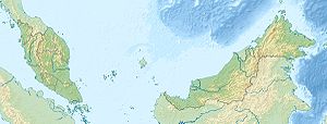
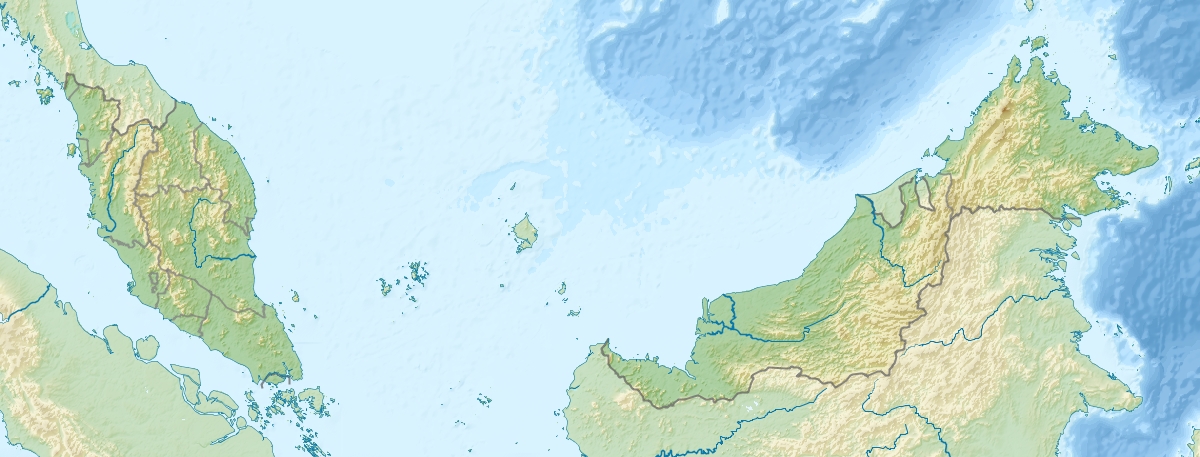
Besonderheiten Höchster Berg der malaiischen Halbinsel

Der Gunung Tahan (indon. Gunung = „Berg“) ist mit 2.187 m der höchste Berg der Malaiischen Halbinsel in Südostasien.

In der Perakkette liegt er im Zentrum des gebirgigen Südteils der Halbinsel, Malakka-Halbinsel genannt. Dort befindet er sich im Taman-Negara-Nationalpark im malaysischen Bundesstaat Pahang.


Wikimedia Foundation.

Игры ⚽ Поможем решить контрольную работу

Schlagen Sie auch in anderen Wörterbüchern nach:

  • Gunung Tahan — Gụnung Tahan,   mit 2 190 m über dem Meeresspiegel der höchste Berg der Malaiischen Halbinsel, im Taman Negara Nationalpark (4 343 km2) …   Universal-Lexikon

  • Gunung — (veraltet auch Goenoeng) ist in der indonesischen und malaiischen Sprache die Bezeichnung für einen Berg oder Vulkan und wird auch als Namenszusatz verwendet. Veraltet wird der Namenszusatz auch für Berge in Osttimor verwendet. Bekannte Berge in… …   Deutsch Wikipedia

  • Gunung — (also known as Gunong ) is the Malay and Indonesian word for mountain it is regularly used in volcano and mountain names throughout Southeast Asia.Mountains using the prefixes Gunung / GunongThe following are mountains that officially use the… …   Wikipedia

  • Tahan, Mount — ▪ mountain, Malaysia Malay  Gunung Tahan        highest peak of the Malay Peninsula (7,175 feet [2,187 m]), in the Tahan Range, West Malaysia. Mount Tahan is the central feature of Taman Negara National Park and a destination for mountaineers who …   Universalium

  • Mount Tahan — Gunung Tahan ڬونوڠ تاهن Gunung Tahan …   Wikipedia

  • Taman Negara — Ansicht des Sungei Tembeling vom Taman Negara …   Deutsch Wikipedia

  • Taman Negara — IUCN Category II (National Park) View of Sungai Tembeling from atop the Canopy Walkway …   Wikipedia

  • Taman Negara National Park — Infobox protected area | name = Taman Negara National Park iucn category = II caption = View of Sungai Tembeling from atop the Canopy Walkway locator x = locator y = location = Malaysia nearest city = Kuala Tembeling lat degrees = lat minutes =… …   Wikipedia

  • Nepenthes gracillima — An upper pitcher of N. gracillima from the upper slopes of Mount Tahan Conservation status …   Wikipedia

  • Ishak Haji Muhammad — (14 November 1909 7 November 1991) or better known as Pak Sako was a prominent Malaysian writer, active in the 1930s until the 1950s. He was a nationalist and his involvement began before independence and continued thereafter. He fought for the… …   Wikipedia

Share the article and excerpts

Direct link
Do a right-click on the link above
and select “Copy Link”