High Nunatak

High Nunatak

f1

High Nunatak
Höhe 1.310 m
Lage Antarktis
Gebirge Ellsworthgebirge
Geographische Lage 80° 3′ 10″ S, 82° 37′ 8″ W-80.052777777778-82.6188888888891310Koordinaten: 80° 3′ 10″ S, 82° 37′ 8″ W
High Nunatak (Antarktis)
High Nunatak

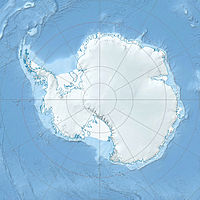
Der High Nunatak ist ein isoliert liegender Nunatak in der Antarktis, der etwa 6,4 Kilometer östlich der Liberty Hills im Horseshoe Valley aus dem Gletschereis ragt.[1]

Er wurde 1966 vom Advisory Committee on Antarctic Names nach Elmer High benannt, dem „Crew Chief“ eines Helikopters des 62nd Transportation Detachments. Dieser hatte einer Forschungsexpedition der University of Minnesota geholfen, die im Sommer 1963–64 in dieser Gegend geologische Forschungen durchführte.[1]

Einzelnachweise

  1. a b High Nunatak (Englisch). Geographic Names Information System. United States Geological Survey. Abgerufen am 16. Juli 2010.

Wikimedia Foundation.

Игры ⚽ Поможем сделать НИР

Schlagen Sie auch in anderen Wörterbüchern nach:

  • Nunatak — Nunataks nahe der Ostküste Grönlands …   Deutsch Wikipedia

  • Nunatak Island — Geography Location Cumberland Sound Coordinates 66°28′N …   Wikipedia

  • Altsek Nunatak — Location of Greenwich Island in the South Shetland Islands …   Wikipedia

  • Chernushka Nunatak — is a nunatak, 1,640 metres (5,380 ft) high, lying 2 miles (3 km) southwest of Sandseten Mountain on the west side of the Westliche Petermann Range in the Wohlthat Mountains. It was discovered and plotted from air photos by the Third… …   Wikipedia

  • Clem Nunatak — is an isolated rock nunatak, 1,260 metres (4,130 ft) high, standing at the west side of Skelton Glacier, 7 miles (11 km) southwest of Halfway Nunatak. It was named by the Advisory Committee on Antarctic Names in 1964 for Willis R. Clem …   Wikipedia

  • Arbanasi Nunatak — Location of Varna Peninsula on Livingston Island in the South Shetland Islands …   Wikipedia

  • Sheppard Nunatak — (coord|63|22|S|56|59|W|) is a conical nunatak 60 m high which stands close north of Sheppard Point, the north side of the entrance to Hope Bay, at the northeast end of Antarctic Peninsula. This area was first explored by a party of the Swedish… …   Wikipedia

  • Cone Nunatak — (63°36′S 57°2′W / 63.6°S 57.033°W / 63.6; 57.033) is a nunatak, 350 metres (1,150 ft) high, which appears conical on its north side but has brown rock cliffs on its south face, lying 3 mi …   Wikipedia

  • Nunatakker — Nunataks nahe der Ostküste Grönlands Nunataks der Osborn Range auf der Ellesmere Insel Nunatak ( …   Deutsch Wikipedia

  • Nunatakkerflur — Nunataks nahe der Ostküste Grönlands Nunataks der Osborn Range auf der Ellesmere Insel Nunatak ( …   Deutsch Wikipedia

Share the article and excerpts

Direct link
Do a right-click on the link above
and select “Copy Link”