Hvalvatn

Hvalvatn
Hvalvatn

Photo-request.svg

Bild gesucht 

BW

Geographische Lage Island
Abfluss Botnsá
Daten
Koordinaten 64° 23′ 0″ N, 21° 10′ 0″ W64.383333333333-21.166666666667378Koordinaten: 64° 23′ 0″ N, 21° 10′ 0″ W
Hvalvatn (Island)
Hvalvatn
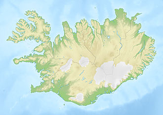
Höhe über Meeresspiegel 378 m
Fläche 4,1 km²f5
Maximale Tiefe 180 mf10
Besonderheiten

dritttiefster See auf Island; Abfluss über den höchsten Wasserfall von Island

Der See Hvalvatn liegt wenige Kilometer östlich des Hvalfjörður im Westen von Island und ist mit bis 180 m Tiefe der dritttiefste See im Land. Seine Fläche misst 4,1 km². [1]

Er liegt östlich zu Füßen des Tafelvulkans Hvalfell und nördlich des Berges Botnssúlur.

Der Fluss Botnsá verlässt den See und stürzt nicht weit davon entfernt neben dem Hvalfell etwa 200 m in die Tiefe. Es handelt sich hierbei um den höchsten Wasserfall Islands, den Glymur. Wanderwege führen zu See und Wasserfall.

Siehe auch

Referenzen

  1. Daten des Sees

Weblinks


Wikimedia Foundation.

Игры ⚽ Нужно сделать НИР?

Schlagen Sie auch in anderen Wörterbüchern nach:

  • Hvalvatn — Infobox lake lake name = Hvalvatn image lake = caption lake = image bathymetry = caption bathymetry = location = coords = coord|64|23|N|21|10|W|region:IS type:waterbody|display=inline,title type = inflow = outflow = catchment = basin countries =… …   Wikipedia

  • Hvalvatn — Le lac Hvalvatn est situé dans l ouest de l Islande. Sa superficie est de 4,1 km2 et sa profondeur maximale est de 160 mètres[1]. Il se trouve aussi à une distance de quelques kilomètres à l est du Hvalfjörður et à l est du volcan Hvalfell.… …   Wikipédia en Français

  • Хвальватн — Эта статья включает материал из этой версии соответствующей статьи английской Википедии. Хвальватн исл. Hvalvatn …   Википедия

  • Hvalfjördur — Hvalfjörður Der Hvalfjörður (isl. Walfjord) liegt im Westen Islands zwischen Mosfellsbær und Akranes. Inhaltsverzeichnis 1 Name 2 Der Tunnel …   Deutsch Wikipedia

  • List of lakes in Iceland — Lakes of Iceland (partially indicating surface or depth)Iceland has about 67 lakes. With a few exceptions, only lakes over 2.5 km² (1 sq mi) in size are included. The figures for many of the smaller lakes are unreliable. Also, some larger lakes… …   Wikipedia

  • Glymur — Infobox Waterfall name=Glymur caption=Waterfall Glymur location=Iceland type=Horsetail height=Convert|196|m|ft|0|abbr=on number drops=1 flow= heightrank= coordinates=coord|64|23|45|N|21|14|28|WThe waterfall Glymur, with a cascade of 196 m, is the …   Wikipedia

  • Öskjuvatn — Coordinates …   Wikipedia

  • Mývatn — Coordinates 65°36′N 17°00′W /  …   Wikipedia

  • List of Iceland-related articles — For a topical list, see List of basic Iceland topics Articles (arranged alphabetically) related to Iceland include: NOTOC 1 9 1. deild karla 101 Reykjavík 12 Tónar 1924 28 Nordic Football Championship 1929 32 Nordic Football Championship 1933 36… …   Wikipedia

  • Hvalfjörður — 64.368083333333 21.693166666667 Koordinaten: 64° 22′ 5″ N, 21° 41′ 35″ W …   Deutsch Wikipedia

Share the article and excerpts

Direct link
Do a right-click on the link above
and select “Copy Link”