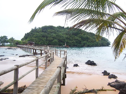
Ilhéu Bombom — Ilhéu Bom Bom o Ilhéu Bombom es un islote que pertenece al país de Santo Tomé y Príncipe, en el Golfo de Guinea. El islote se encuenta al norte de la costa de la isla de Príncipe, a 1º N 7º O. Incluye un par de centros turísticos. No hay… … Wikipedia Español
Ilheu Bom Bom — Ilhéu Bom Bom, also Ilhéu Bombom is an island in the Gulf of Guinea. The islet is located north of the coast of the island of Príncipe, one of the main islands of São Tomé and Príncipe. The island includes a couple of tourist resorts in São Tomé… … Wikipedia
Isla de Príncipe — Para otros usos de este término, véase Príncipe (desambiguación). Isla del Príncipe Ilha do Príncipe Localización País Santo Tomé y Príncipe … Wikipedia Español
Geografía de Santo Tomé y Príncipe — Santo Tomé y Príncipe se encuentra situado en el Atlántico, al sur de la isla de Fernando Poo, (Guinea Ecuatorial) en el Golfo de Guinea. Dista 300 km al noroeste de la costa de Gabón, y es el país africano de menor superficie. El país está… … Wikipedia Español
Príncipe — Infobox STP provinces capital=Santo António area=136 km² lowest=Atlantic Ocean centre=Santo António highest=Pico de Príncipe (948 m) population=around 5,000 density=about 36 totaldistricts=1 (Pagué) phone number=19x xxxx? inhabitants=Príncipean… … Wikipedia
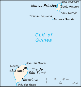
 Karte von São Tomé und Príncipe - Ilheu Bom Bom ganz im Norden