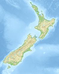
Inch Clutha

Inch Clutha

Vorlage:Infobox Insel/Wartung/Bild fehltVorlage:Infobox Insel/Wartung/Fläche fehltVorlage:Infobox Insel/Wartung/Höhe fehlt

Inch Clutha
Gewässer Clutha River
Geographische Lage 46° 18′ 0″ S, 169° 47′ 0″ O-46.3169.78333333333Koordinaten: 46° 18′ 0″ S, 169° 47′ 0″ O
Inch Clutha (Neuseeland)
Inch Clutha
Länge 10 km
Breite 3 km

Inch Clutha ist eine große, flache Insel im Delta des Clutha River auf der Südinsel Neuseelands. Sie liegt flussabwärts von der Stadt Balclutha und ist etwa 10 km lang und 3 km breit.

Das fruchtbare, aber von Überflutung bedrohte Land wird intensiv landwirtschaftlich genutzt.

Der Name der Insel leitet sich aus der Schottisch-Gälische Sprache ab: innis bedeutet "Insel" und Cluaidh ist der Gälische Name des schottischen Flusses River Clyde.


Wikimedia Foundation.

Игры ⚽ Поможем сделать НИР

Schlagen Sie auch in anderen Wörterbüchern nach:

  • Inch Clutha — is a large, flat island sitting in the delta of the Clutha River in the South Island of New Zealand, downstream from the town of Balclutha. Approximately ten kilometres in length and three kilometres in width, the fertile but flood prone land of… …   Wikipedia

  • Clutha River — / Mata Au The Clutha River system. Mouth Pacific Ocean Basin countries New Zealand Length …   Wikipedia

  • Clutha River — Der Clutha River in der Nähe von RoxburghVorlage:Infobox Fluss/KARTE fehlt Daten …   Deutsch Wikipedia

  • Clutha — may refer to: Clutha ferry passenger steamers on the River Clyde in Glasgow from 1884 to 1903 Clutha (dance), a Scottish country dance The Clutha, a traditional Scottish band Clutha River in New Zealand, named after the Clyde Clutha District, New …   Wikipedia

  • Clutha District — The Clutha District is an administrative district of southern New Zealand, with its headquarters in the Otago town of Balclutha. The Clutha District has a land area of 6,362.86 km² (2,456.71 sq mi) and a 2006 census population of 16,839 usual… …   Wikipedia

  • Clutha (fleuve) — 44° 39′ 54″ S 169° 09′ 29″ E / 44.6649, 169.158 …   Wikipédia en Français

  • Clutha River — River, New Zealand. The longest river in South Island, it rises in the Southern Alps and flows southeast 200 mi (320 km) to the sea. Its valley supports sheep, beef, grain, and fruit farming in the upper reaches and vegetable and dairy farming in …   Universalium

  • Clyde Dam — from the east, looking west …   Wikipedia

  • Cromwell, New Zealand — Cromwell …   Wikipedia

  • South Otago — lies in the south east of the South Island of New Zealand. As the name suggests, it forms the southernmost part of the geographical region of Otago. The exact definition of the area designated as South Otago is imprecise, as the area is not… …   Wikipedia

Share the article and excerpts

Direct link
Do a right-click on the link above
and select “Copy Link”