- KPAE
-
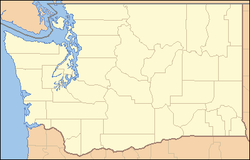
Snohomish County Airport - Paine Field Kenndaten IATA-Code PAE ICAO-Code KPAE Koordinaten 47° 54′ 23″ N, 122° 16′ 54″ W47.906341666667-122.28156388889185Koordinaten: 47° 54′ 23″ N, 122° 16′ 54″ W 185 m ü. MSLVerkehrsanbindung Entfernung vom Stadtzentrum 9 km südwestlich von Everett (Washington) Straße I-5/WA 525/WA 526 Basisdaten Eröffnung November 1938 Fläche Start- und Landebahnen 16R/34L 2.746 m × 46 m Asphalt 11/29 1.376 m × 23 m Asphalt 16L/34R 914 m × 23 m Asphalt Der Snohomish County Airport, auch Paine Field (IATA: PAE, ICAO: KPAE) genannt, ist der regionale Flughafen von Snohomish County in der Stadt Everett im US-Bundesstaat Washington. Er ist nach dem aus Everett stammenden Lt. Topliff O. Paine benannt.
Direkt am Flughafen befindet sich das Boeing-Werk Everett.
Geschichte
Der Bau des Flugplatzes begann 1936 mit den Landebahnen 11/29 und der später stillgelegten 3/21, die offizielle Eröffnung fand im November 1938 statt. 1941 übernahm das US Army Air Corps den Flugplatz, welches nach dem Ende des Zweiten Weltkrieges ab 1946 wieder die zivile Nutzung zuließ und den Flugplatz 1948 endgültig räumte. Doch bereits 1951 wurde der Flugplatz größtenteils wieder vom Militär übernommen - diesmal für den Korea-Krieg. Es erfolgte die Umbenennung in Paine Air Force Base. 1966 zog sich die US Air Force wieder vollständig zurück. Als im gleichen Jahr der Flugzeughersteller Boeing nach einem Gelände suchte, welche für den Bau des in Planung befindlichen Großraumflugzeuges Boeing 747 geeignet war, wurde das weiträumige freie Gelände nördlich des Flugplatzes gewählt. Für den neuen Flugzeugtyp musste die Infrastruktur entsprechend ausgebaut werden, so entstand unter anderem die Start- und Landebahn 16R/34L. Um der allgemeinen Luftfahrt mehr Kapazitäten zu schaffen, wurde in den 1980er Jahren noch die Landebahn 16L/34R sowie die östlich davon befindlichen Hangars gebaut.
Weblinks
- Flughafendaten von World Aero Data (englisch)
- Website des Flughafens (englisch)
- Bilder vom Paine Field (englisch)
Wikimedia Foundation.


