Anartutu

Anartutu
Die Insel Atauro
Macadade (Osttimor)
DMS
Macadade
Macadade
Lage von Macadade in Osttimor

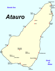
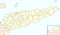
Macadade (ehemals Anartutu) ist einer der fünf Sucos und die zweitgrößte Ortschaft der osttimoresischen Insel Atauro (Distrikt Dili). Der Ort liegt im Süden der Insel in 121 Metern Höhe über dem Meer. Im Suco leben 1.436 Menschen (2004).

Mittwochs wird hier ein Markt abgehalten, auf dem Fisch, Ziegen, Gemüse und Hühner verkauft werden.

In der Umgebung von Vila wird der Dialekt Raklungu gesprochen, der zur Nationalsprache Wetar (auch Atauru oder Adabe) gehört. Der Dialekt wird vom ansässigen Adade-Stamm gesprochen.

-8.3125.533333333337Koordinaten: 8° 18′ S, 125° 32′ O


Wikimedia Foundation.

Игры ⚽ Нужен реферат?

Schlagen Sie auch in anderen Wörterbüchern nach:

  • Atauro Island — (also Pulau Atauro, Ataúro) is a small island situated 25km north of Dili, East Timor, on the extinct Wetar segment of the volcanic Inner Banda Arc, between the Indonesian islands of Alor and Wetar. Politically it comprises one of the… …   Wikipedia

  • Atauro — Subdistrikt Atauro Hauptstadt Atauro Fläche 140,50 km²[1] Einwohnerzahl 8.602 (2010) …   Deutsch Wikipedia

  • Ataúro — Subdistrikt Atauro Hauptstadt Atauro Einwohnerzahl (2004)[1] 7.863 Fläche 140 km²[2] …   Deutsch Wikipedia

  • Macadade — Suco Macadade Daten Fläche 35,35 km²[1] Einwohnerzahl 1.486 (2010) …   Deutsch Wikipedia

  • Pulo Cambing — Subdistrikt Atauro Hauptstadt Atauro Einwohnerzahl (2004)[1] 7.863 Fläche 140 km²[2] …   Deutsch Wikipedia

Share the article and excerpts

Direct link
Do a right-click on the link above
and select “Copy Link”