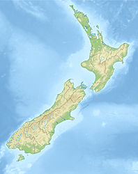
- Anchor Island
-
Anchor Island Gewässer Dusky Sound Geographische Lage 45° 45′ 29,45″ S, 166° 31′ 12,43″ O-45.75818166.52012417Koordinaten: 45° 45′ 29,45″ S, 166° 31′ 12,43″ O Fläche 13,8 km² Höchste Erhebung 417 m Einwohner (unbewohnt) Anchor Island (in der Sprache der Maori Pukenui) ist eine Insel im Dusky Sound im Fiordland-Nationalpark im Distrikt Southland in Neuseeland. Die Insel hat eine Fläche von 1380 Hektar, eine Höhe von 417 m und ist 2,5 km vom Festland entfernt. Sie wird vom Department of Conservation als Schutzgebiet für gefährdete Vogelarten wie Tieke (Philesturnus carunculatus) und Kakapo genutzt.
Film
- http://www.elwin.co.nz Elwin Productions with footage of the Kakapo and Anchor Island.
Wikimedia Foundation.

