Kensington (New South Wales)

Kensington (New South Wales)
City of Randwick
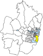
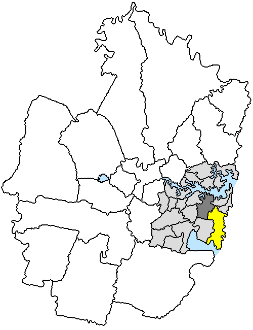
Lage der Randwick City in Sydney
Basisdaten
Bundesstaat: New South Wales
Hauptort: Randwick
Fläche: 36 km²
Einwohner: 126.877 (Juni 2006)
Wards: 5
Stadtteile: 38

Randwick City ist ein lokales Verwaltungsgebiet (LGA) im australischen Bundesstaat New South Wales. Randwick gehört zur Metropole Sydney, der Hauptstadt von New South Wales. Das Gebiet ist 36 km² groß und hat etwa 127.000 Einwohner.

Randwick liegt an der Pazifikküste in der Inner City von Sydney und grenzt im Nordwesten an das Stadtzentrum. Das Gebiet beinhaltet 38 Stadtteile: Bare Island, Bunnerong, Chifley, Clovelly, Clovelly West, Coogee, Coogee Bay, Coogee North, Coogee South, Kensington, Kensington South, La Perouse, Little Bay, Long Bay, Lurline Bay, Malabar, Malabar Heights, Malabar Junction, Maroubra, Maroubra Bay, Maroubra Beach, Maroubra Junction, Maroubra South, Phillip Bay, Port Botany, Prince Henry Hospital, Randwick, Randwick North, Randwick South, St Pauls, University of NSW, Yarra Bay, Yarra Junction und Teile von Centennial Park, Caceyville, Kingsford, Matraville und Pagewood. Der Verwaltungssitz des Councils befindet sich im Stadtteil Randwick im Norden der LGA.

Verwaltung

Der Randwick City Council hat 15 Mitglieder, die von den Bewohnern der fünf Wards gewählt werden (je drei aus Central, East, North, South und West Ward). Diese fünf Bezirke sind unabhängig von den Ortschaften festgelegt. Aus dem Kreis der Councillor rekrutiert sich auch der Mayor (Bürgermeister) des Councils.

Weblinks

-33.916666666667151.257Koordinaten: 33° 55′ S, 151° 15′ O


Wikimedia Foundation.

Игры ⚽ Нужна курсовая?

Schlagen Sie auch in anderen Wörterbüchern nach:

  • Kensington, New South Wales — Infobox Australian Place | type = suburb name = Kensington city = Sydney state = nsw caption = Uniwalk at the University of NSW lga = City of Randwick postcode = 2033 pop = area = est = propval = stategov = Heffron, Coogee fedgov = Kingsford… …   Wikipedia

  • New College, University of New South Wales —                 …   Wikipedia

  • South Coogee, New South Wales — South Coogee Sydney, New South Wales Shopping strip, Malabar Road Postcode …   Wikipedia

  • Maroubra, New South Wales — For the New South Wales Legislative Assembly Electorate, see Electoral district of Maroubra. Maroubra Sydney, New South Wales Maroubra Beach …   Wikipedia

  • Coogee, New South Wales — Coogee Sydney, New South Wales Coogee Beach, view from Dolphin Point at the northern end …   Wikipedia

  • Kingsford, New South Wales — Infobox Australian Place | type = suburb name = Kingsford city = Sydney state = NSW caption = Anzac Parade, Kingsford lga = City of Randwick postcode = 2032 est = pop = area = propval = stategov = Maroubra fedgov = Kingsford Smith near nw = Moore …   Wikipedia

  • Matraville, New South Wales — Matraville Sydney, New South Wales Eastern Suburbs Memorial Park …   Wikipedia

  • Malabar, New South Wales — For other uses, see Malabar (disambiguation). Malabar Sydney, New South Wales Long Bay, Malabar …   Wikipedia

  • Clovelly, New South Wales — Clovelly Sydney, New South Wales Clovelly Beach Population: 4,426 (2006) …   Wikipedia

  • Waterloo, New South Wales — Infobox Australian Place | type = suburb name = Waterloo city = Sydney state = caption = Regent Street, Waterloo lga = City of Sydney postcode = 2017 est = 1815 pop = 8,508 area = 1.1 propval = stategov = Heffron fedgov = Sydney near nw =… …   Wikipedia

Share the article and excerpts

Direct link
Do a right-click on the link above
and select “Copy Link”