Kgalagadi District Municipality
- Kgalagadi District Municipality
-
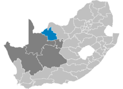
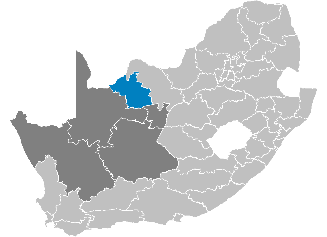
Kgalagadi [kxalaxadi] (Beˈtonung fehlt) ist ein Distrikt in der Provinz Nordkap in Südafrika. Im Jahr 2001 betrug die Bevölkerung 185.274 auf einer Gesamtfläche von 23.681 km². Sitz der Distriktverwaltung ist Kuruman. [1]
Kgalagadi ist ein Setswana-Word für großer Abstand. "Kgala" bedeutet Abstand und "gadi" bedeutet groß bzw. weit. Da die europäischen Siedler das Word nicht richtig aussprechen konnten, wurde es lange Zeit als Kalahari falsch geschrieben. [2]
Gemeinden (Local Municipalities) mit ihren größten Städten
und eine District Management Area Lage siehe rechts
Nachbardistrikte sind :
Weblinks
- ↑ Gemeindegrenzen Südafrika
- ↑ Namensbedeutung Gemeinden
-27.4523.47Koordinaten: 27° S, 23° O
Wikimedia Foundation.
Schlagen Sie auch in anderen Wörterbüchern nach:
Kgalagadi District Municipality — Zamuni code=DC45 location= area= seat=Kuruman neighbours= mayor= population=176 899 [ [http://www.demarcation.org.za/municprofiles2003/index.asp Municipal Profiles] ] population density= habitations= habitation density= races= languages=Setswana… … Wikipedia
Dr Ruth Segomotsi Mompati District Municipality — A map of the North West showing Dr Ruth Segomotsi Mompati Dr Ruth Segomotsi Mompati District Municipality (formerly Bophirima District Municipality[1]) is one of the 4 districts of North West prov … Wikipedia
Siyanda District Municipality — Siyanda is one of the 5 districts of the Northern Cape province of South Africa. The seat of Siyanda is Upington. The majority of its 209 883 [ [http://www.demarcation.org.za/municprofiles2003/index.asp Municipal Profiles] ] people speak… … Wikipedia
Central District Municipality — Central is one of the four districts of North West province in South Africa. Its capital is Mafikeng, which is also the capital of the province.GeographyNeighboursCentral has the following neighbours: * The Republic of Botswana to the north *… … Wikipedia
Kgalagadi (Distrikt) — Kgalagadi Kgalagadi District Municipality Kgalagadi (blau) in Nordkap (dunkelgrau) Staat: Südafrika … Deutsch Wikipedia
Kgalagadi — bezeichnet: die Kalahari Wüste auf Setswana eine Sprache im südlichen Afrika, siehe Kgalagadi (Sprache) einen Distrikt in Botsuana, siehe Kgalagadi District einen Distrikt in der südafrikanischen Nordkap Provinz, siehe Kgalagadi District… … Deutsch Wikipedia
Bophirima District Municipality — Bophirima is one of the 4 districts of North West province of South Africa. The seat of Bophirima is Vryburg. The majority of its 439 637 people speak Setswana (2001 Census). The district code is DC39. It is South Africa s largest beef producing… … Wikipedia
District Management Area — A map of South African districts showing the District Management Areas before 2011 In South Africa, District Management Area (DMA) was the name given to areas within a district municipality that did not fall within any local municipality, and… … Wikipedia
Mier Local Municipality — Mier Local municipality Location in the N … Wikipedia
Distrikte Südafrikas — (nummeriert) Südafrika ist in 52 Distrikte aufgeteilt. Es gibt 6 Metropolitan (gekennzeichnet mit *) und 46 District Municipalitys). Inhaltsverzeichnis 1 Westkap 2 Ostkap … Deutsch Wikipedia