- LGSR
-
Flughafen Santorin
Airport Santorini
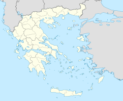
Αερολιμένας ΣαντορίνηςKenndaten IATA-Code JTR ICAO-Code LGSR Koordinaten 36° 23′ 57″ N, 25° 28′ 46″ O36.39916944444425.47933333333339Koordinaten: 36° 23′ 57″ N, 25° 28′ 46″ O 39 m ü. MSLVerkehrsanbindung Entfernung vom Stadtzentrum 8 km südöstlich von Thira Straße Basisdaten Eröffnung 1972 Fläche Start- und Landebahnen 16L/34R (geschlossen) 2.125 m × 30 m Asphalt 16R/34L 2.125 m × 30 m Asphalt Der Flughafen Santorin (griech. Κρατικός Αερολιμένας Σαντορίνης (Kratikos Aerolimenas Santorinis)) ist ein griechischer Flughafen auf der Insel Santorin. Er liegt im Südosten der Insel nahe der Küste bei Monolithos und Kamari, etwa 8 km von der Hauptstadt Thira.
Der Flughafen wurde 1972 eröffnet und besitzt heute ein beleuchtetes Vorfeld mit Parkmöglichkeit für zwei Flugzeuge, sowie ein 1989 erbautes Terminalgebäude. Im Flughafengebäude befinden sich Reisebüros, kleine Restaurants, Autovermietungen sowie Büros von Fluggesellschaften. Außerdem besteht die Möglichkeit zum steuerfreien Einkaufen.
Neben der aktiven Start- und Landebahn 16L/34R befindet sich westlich die Bahn 16R/34L, die allerdings geschlossen ist und nur als Taxiway benutzt wird.
Busse nach Thira Busbahnhof (zentral in der Stadt) alle 90 Minuten (8-19 Uhr). Fahrzeit: 15 Minuten. Von dort gibt es Busse nach Oia (halbstündlich; Fahrzeit ca. 25 min), Akrotiri (alle 1 1/2 Stunden, Fahrzeit ca. 40 min), Perissa (stündlich, Fahrzeit ca. 30 min), Kamari (halbstündlich; Fahrzeit ca. 15 min).
Weblinks
- hcaa-eleng.gr Offizielle Website der griechischen Aufsichtsbehörde für Zivilluftfahrt (griech./engl.)
Wikimedia Foundation.

