Lachamp-Raphaël

Lachamp-Raphaël
Lachamp-Raphaël
Lachamp-Raphaël (Frankreich)
Lachamp-Raphaël
Region Rhône-Alpes
Département Ardèche
Arrondissement Largentière
Kanton Antraigues-sur-Volane
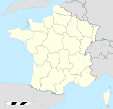
Koordinaten 44° 49′ N, 4° 17′ O44.8105555555564.29055555555561320Koordinaten: 44° 49′ N, 4° 17′ O
Höhe 1.320 m (1.058–1.445 m)
Fläche 14,09 km²
Einwohner 86 (1. Jan. 2008)
Bevölkerungsdichte 6 Einw./km²
Postleitzahl 07530
INSEE-Code
Website http://www.lachamp-raphael.com/

Südostansicht von Lachamp-Raphaël

Lachamp-Raphaël ist eine französische Gemeinde mit 86 Einwohnern (Stand 1. Januar 2008) im Département Ardèche. Sie ist Teil des Regionalen Naturparks Monts d’Ardèche.

Bevölkerungsentwicklung

Bevölkerungsentwicklung
1962 1968 1975 1982 1990 1999 2007
189 227 184 157 115 117 89
Ab 1968 offizielle Zahlen ohne Einwohner mit Zweitwohnsitz
Die Kaskaden von Ray Pic liegen auf dem Gebiet der Gemeinde

Wikimedia Foundation.

Игры ⚽ Нужен реферат?

Schlagen Sie auch in anderen Wörterbüchern nach:

  • Lachamp-Raphael — Lachamp Raphaël Lachamp Raphaël Pays   …   Wikipédia en Français

  • Lachamp-raphaël — Pays   …   Wikipédia en Français

  • Lachamp-Raphaël — Lachamp Raphaël …   Wikipedia Español

  • Lachamp-Raphaël — 44° 48′ 41″ N 4° 17′ 27″ E / 44.8113888889, 4.29083333333 …   Wikipédia en Français

  • Lachamp-Raphaël — Infobox Commune de France nomcommune=Lachamp Raphaël région=Rhône Alpes département=Ardèche arrondissement=Privas canton=Antraigues sur Volane insee=07120 cp=07530 maire=Dominique Allix mandat=2001 2008 intercomm= longitude=4.29083333333 latitude …   Wikipedia

  • Saint-André-Lachamp — Pour les articles homonymes, voir Saint André. 44° 30′ 21″ N 4° 09′ 51″ E …   Wikipédia en Français

  • Saint-Genest-Lachamp — Pour les articles homonymes, voir Saint Genest et Lachamp. 44° 50′ 52″ N 4° 25′ 2 …   Wikipédia en Français

  • Mézilhac — 44° 48′ 31″ N 4° 21′ 09″ E / 44.8086, 4.3525 …   Wikipédia en Français

  • Labastide-sur-Bésorgues — Pour les articles homonymes, voir Labastide. Pour les articles homonymes, voir Bésorgues (homonymie) …   Wikipédia en Français

  • Laviolle — 44° 45′ 49″ N 4° 20′ 24″ E / 44.7636, 4.34 …   Wikipédia en Français

Share the article and excerpts

Direct link
Do a right-click on the link above
and select “Copy Link”