- Lane Cove Municipality
-
Municipality of Lane Cove 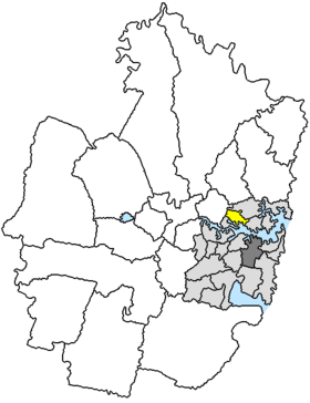
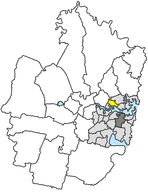
Lage der Lane Cove Municipality in SydneyGliederung Staat:  Australien
Bundesstaat:  New South Wales
Verwaltungssitz: Lane Cove Daten und Zahlen Fläche: 11 km² Einwohner: 30.427 (2006) [1] Bevölkerungsdichte: 2.766 Einwohner je km² Wards: 3 -33.75151.15Koordinaten: 33° 45′ S, 151° 9′ ODie Municipality of Lane Cove ist ein lokales Verwaltungsgebiet (LGA) im australischen Bundesstaat New South Wales. Lane Cove gehört zur Metropole Sydney, der Hauptstadt von New South Wales. Das Gebiet ist 11 km² groß und hat etwa 30.000 Einwohner.
Lane Cove liegt etwa 6 km nordwestlich des Stadtzentrums von Sydney an der Nordseite des Hafens. Das Gebiet beinhaltet 18 Stadtteile: Blaxslands Corner, Greenwich, Greenwich Point, Linley Point, Longueville, Northwood, Osborne Park, Riverview, Tambourine Bay, West Lane Cove und Teile von Artarmon, Chatswood West, Crows Nest, Gore Hill, Lane Cove, North Lane Cove, St Leonards und Wollstonecraft. Der Sitz des Municipality Councils befindet sich im Stadtteil Lane Cove am Nordrand der LGA.
Verwaltung
Der Lane Cove Council hat neun Mitglieder, die von den Bewohnern der drei Wards gewählt werden (je drei Councillor aus Central, East und West Ward). Diese drei Bezirke sind unabhängig von den Stadtteilen festgelegt. Aus dem Kreis der Councillor rekrutiert sich auch der Mayor (Bürgermeister) des Councils.
Weblinks
Einzelnachweise
- ↑ Australian Bureau of Statistics (25. Oktober 2007): Lane Cove (A) (Local Government Area) (Englisch). 2006 Census QuickStats. Abgerufen am 6. April 2010.
Kategorien:- Local Government Area in New South Wales
- Local Government Area in Sydney
Wikimedia Foundation.