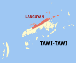
Languyan — Original name in latin Languyan Name in other language Languyan State code PH Continent/City Asia/Manila longitude 5.2618 latitude 120.0807 altitude 76 Population 8900 Date 2012 01 17 … Cities with a population over 1000 database
Languyan, Tawi-Tawi — Languyan is a 3rd class municipality in the province of Tawi Tawi, Philippines. According to the 2000 census, it has a population of 42,040 people in 7,771 households.BarangaysLanguyan is politically subdivided into 20 barangays. * Bakong * Bas… … Wikipedia
Tawi-Tawi — Infobox Philippine province name = Tawi Tawi sealfile = Ph seal tawi tawi.png region = Autonomous Region in Muslim Mindanao (ARMM) capital = Panglima Sugala founded = 1972 pop2000 = 322,317 pop2000rank = 17th smallest popden2000 = 296… … Wikipedia
PH-TAW — Karte der Philippinen mit der Lage von Tawi Tawi Tawi Tawi ist eine Inselgruppe und eine Provinz der Philippinen, die politisch dem Bezirk Autonomen Region Muslim Mindanao angehört. Provinz ist die südlichste im Land. Die Hauptstadt von Tawi Tawi … Deutsch Wikipedia
List of islands of the Philippines — This is a list of islands of the Philippines. There are 7,107 islands, of which about 4,000 are inhabited. They are clustered into the island groups of Luzon, Visayas, and Mindanao.Luzon**Batanes Islands ***Batan Island ***Diadekey Island… … Wikipedia
Mapun, Tawi-Tawi — Mapun is a 4th class remote municipality in the province of Tawi Tawi, Philippines. According to the 2000 census, it has a population of 22,011 people in 3,492 households. Mapun (formerly Cagayan de Tawi Tawi or Cagayan de Sulu) is an island in… … Wikipedia
Sumisip, Basilan — Sumisip is a 3rd class municipality in the province of Basilan, Philippines. According to the 2000 census, it has a population of 51,712 people in 8,698 households.BarangaysSumisip is politically subdivided into 41 barangays. * Bacung *… … Wikipedia
List of cities and municipalities in the Philippines — This is a list of cities and municipalities in the Philippines arranged by province and in alphabetical order. As of 2006, there are 118 cities and 1509 municipalities.As of September 4, 2007, there are 136 cities, 1,495 municipalities, 81… … Wikipedia
List of ZIP Codes in the Philippines — In the Philippines, the Philippine ZIP code is used by the Philippine Postal Corporation (Philpost) to simplify the distribution of mail. While in function it is similar to the ZIP code used in the United States, its form and its usage is quite… … Wikipedia
Hadji Mohammad Ajul, Basilan — Hadji Mohammad Ajul is a municipality in the province of Basilan, Philippines. It was created by Muslim Mindanao Autonomy Act No. 192, ratified by plebiscite on May 22, 2006. It is composed of 11 barangays that were formerly part of… … Wikipedia


