Leonard Kniaseff — Infobox Mountain Name=Leonard Kniaseff Elevation= convert|1190|m|ft|0|lk=onVNUM|1=0701 031|2=Leonard Range] Location=Mindanao, Philippines Prominence = Coordinates =coord|7|22|54|N|126|2|48|E|region:PH type:mountain Type=Stratovolcano Age= Last… … Wikipedia
Compostela Valley (Provinz) — Lage von Compostela Valley Compostela Valley ist eine Provinz im Südosten der Insel Mindanao und gehört zu dem Inselstaat der Philippinen. Die Provinz ist politisch dem Bezirk Davao Region, der Region XI, zugeordnet. Der Sitz der… … Deutsch Wikipedia
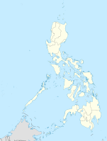
PH-COM — Lage von Compostela Valley Compostela Valley ist eine Provinz im Südosten der Insel Mindanao und gehört zu dem Inselstaat der Philippinen. Die Provinz ist politisch dem Bezirk Davao Region, der Region XI, zugeordnet. Der Sitz der… … Deutsch Wikipedia
Davao del Norte — / Davao Probinsya ng Davao del Norte / Davao Province Map of the Philippines with Davao del No … Wikipedia
Babuyan Claro — volcano is located in the Babuyan Islands, an archipelago in the Luzon Strait and north of Luzon island in the Philippines (19°31.5 N, 121° 57 E). It is separated from Luzon by the Babuyan Channel and from the Batanes Islands up north by the… … Wikipedia
Cagua Volcano — is located in northern Luzon island in the Philippines (18°13.3 N, 122°7.4 E). It is in the political jurisdiction of the province of Cagayan in the Cagayan Valley region.Physical featuresVolcanologists classify Cagua Volcano as a stratovolcano… … Wikipedia
Kanlaon — Infobox Mountain Name= Mount Kanla on Photo= Mount Kanla on.jpg Caption= Mount Kanla on Elevation=2435 metres Location= Negros Island, Philippines Prominence = 2435 metres pushpin pushpin label position = left pushpin map caption = pushpin… … Wikipedia
Camiguin de Babuyanes — is an active volcano on Calayan Island, one of the Babuyan Islands, (18°50 N, 121°51.6 E) in the Philippines. It is under the political jurisdiction of the province of Cagayan in the admnistrative region of Cagayan Valley.Physical… … Wikipedia
Iraya — Iraya, or Mount Iraya, is an active volcano on one of the Batanes Islands in the province of Batanes (20°29 N, 124°01 E) in the Philippines. It is the northernmost active volcano in the Philippines.Physical featuresIraya is a stratovolcano rising … Wikipedia
Matutum — Volcano, is a volcano on the island of Mindanao in the Philippines. It is 15 km north of Polomolok, South Cotabato and about 30 km north northwest of General Santos City (6°22 N, 125°06.5 E).Physical featuresMatutum is a stratovolcano that rises… … Wikipedia