Llanfynydd

Llanfynydd
51.92993-4.10159
Llanfynydd (Vereinigtes Königreich)
Llanfynydd
Llanfynydd

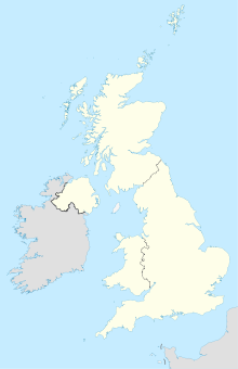
Llanfynydd ist ein kleiner Ort mit 538 Einwohnern (Volkszählung 2001) in Carmarthenshire in Wales. Er liegt in der Nähe des Brecon-Beacons-Nationalpark und des National Botanic Garden of Wales. Die Hauptsehenswürdigkeit ist die alte Dorfkirche. Einnahmequellen des Ortes sind der Tourismus und die Landwirtschaft.

Aus Protest gegen eine Windkraftanlage, die in Llanfynydd aufgestellt werden sollte, benannte sich der Ort im Juli 2004 in „Llanhyfryddawelllehynafolybarcudprindanfygythiadtrienusyrhafnauole“ um, was übersetzt so viel bedeutet wie: „Ruhiges schönes Dorf, ein historischer Ort mit seltenen Vögeln, die von verdammten Rotorblättern bedroht werden“. Dieser Name ist jedoch nicht offiziell.

Mit 66 Buchstaben ist dieser selbstgewählte Ortsname noch etwas länger als Llanfairpwllgwyngyllgogerychwyrndrobwllllantysiliogogogoch (nur 58 Buchstaben) und wäre mit einer offiziellen Anerkennung durch die zuständigen Behörden der längste Ortsname Europas.

Weblinks

 Commons: Llanfynydd – Sammlung von Bildern, Videos und Audiodateien

Wikimedia Foundation.

Игры ⚽ Поможем написать курсовую

Schlagen Sie auch in anderen Wörterbüchern nach:

  • Llanfynydd — See also: Llanfynydd, Flintshire Llanfynydd is a village in Carmarthenshire, Wales.In protest over plans to erect a wind farm nearby, on 19 July 2004 the village adopted the new name of Llanhyfrydawelllehynafolybarcudprindanfygythiadtrienusyllafna… …   Wikipedia

  • Llanfynydd — Original name in latin Llanfynydd Name in other language Llanfyndd, Llanfynydd State code GB Continent/City Europe/London longitude 51.92806 latitude 4.09889 altitude 157 Population 0 Date 2011 07 31 …   Cities with a population over 1000 database

  • Llanhyfrydd — DEC …   Deutsch Wikipedia

  • Ffrith — is a small village in Llanfynydd parish in Flintshire, north east Wales. It is situated in the southernmost part of the county in the valley of the River Cegidog at the point where the Nant y Ffrith stream flows into it. Neighbouring villages… …   Wikipedia

  • Carmarthenshire — Not to be confused with Caernarfonshire. County of Carmarthenshire Sir Gaerfyrddin Geography Area Total  % Water …   Wikipedia

  • Carmarthen — Not to be confused with Caernarfon or Cwmafan. Coordinates: 51°51′22″N 4°18′58″W / 51.856°N 4.316°W / 5 …   Wikipedia

  • Newcastle Emlyn — Coordinates: 52°02′N 4°28′W / 52.04°N 4.47°W / 52.04; 4.47 …   Wikipedia

  • Kidwelly — Coordinates: 51°44′11″N 4°18′26″W / 51.73634°N 4.30714°W / 51.73634; 4.30714 …   Wikipedia

  • St Clears — Coordinates: 51°49′14″N 4°30′15″W / 51.82043°N 4.50424°W / 51.82043; 4.50424 …   Wikipedia

  • List of communities in Wales — This is a list of communities in Wales sorted by principal area. The community is the lowest tier of local government in Wales and is usually represented by a community council. Contents 1 Blaenau Gwent 2 Bridgend 3 Caerphilly …   Wikipedia

Share the article and excerpts

Direct link
Do a right-click on the link above
and select “Copy Link”