- Loch Katrine
-
Loch Katrine 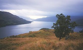
Geographische Lage Stirling, Schottland Abfluss Teith → Forth Größere Städte in der Nähe Glasgow Daten Koordinaten 56° 15′ 16″ N, 4° 30′ 56″ W56.254444444444-4.5155555555556Koordinaten: 56° 15′ 16″ N, 4° 30′ 56″ W 

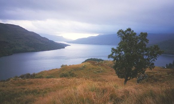
Loch Katrine (gälisch: Loch Ceiterein) ist ein aufgestauter Süßwassersee in Schottland. Er liegt in der Unitary Authoritiy Stirling und hat die typisch langgezogene Form eines während der Eiszeit durch Gletscher entstandenen Sees. Loch Katrine ist etwa 13 Kilometer lang, aber im Mittel nur einen Kilometer breit.
Loch Katrine ist das primäre Wasserreservoir des Großraums Glasgow. Benzin- bzw. dieselbetriebene Schiffe sind auf dem Gewässer nicht erlaubt, um eine Verschmutzung des Trinkwassers Glasgows zu vermeiden. Das Schiff SS Sir Walter Scott bietet seit 1899 Touristen-Ausflüge über den See an. Es wird mit einer 3-fach-Expansionsdampfmaschine angetrieben und wurde bis zum 28. Oktober 2007 mit Kohle befeuert. Während der Winterpause 2007/2008 wurde das Schiff auf Biodiesel umgerüstet und nahm im Mai 2008 den Betrieb wieder auf.
Sir Walter Scott widmete Loch Katrine das Gedicht The Lady of the Lake, das von Gioachino Rossini zu der Oper La Donna del Lago umgearbeitet wurde.
Von Frühling bis Herbst sind auf dem See Fliegenfischen und Fischen nach Forellen erlaubt.
Loch Katrine ist ebenfalls der Name eines Sees in North Canterbury, Neuseeland.
Weblinks
 Commons: Loch Katrine – Sammlung von Bildern, Videos und Audiodateien
- Beschreibung der Sees (englisch)
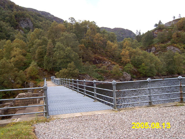
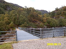 Die Staumauer am Loch Katrine
 Kategorien:
- See in Europa
- See in Schottland
- Gewässer in der Unitary Authority Stirling
Wikimedia Foundation.