Mare aux Vacoas

Mare aux Vacoas
Mare aux Vacoas

Photo-request.svg

Bild gesucht 

BW

Geographische Lage Mauritius
Abfluss Rivière du Poste
Größere Städte in der Nähe Curepipe
Daten
Koordinaten 20° 22′ 30″ S, 57° 30′ 15″ O-20.37557.504166666667Koordinaten: 20° 22′ 30″ S, 57° 30′ 15″ O
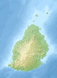
Mare aux Vacoas (Mauritius)
Mare aux Vacoas
Fläche 2,6 km²dep1f5
Besonderheiten

Stausee

Das Mare aux Vacoas ist das größte Trinkwasserreservoir auf Mauritius und liegt etwa fünf Kilometer südlich der Stadt Curepipe im Distrikt Plaines Wilhems.

Die annähernd rechteckige, knapp drei Quadratkilometer große Talsperre, die auch der Energiegewinnung dient, hat etwa zwei Kilometer lange Längsseiten in Nordwest-Südost-Richtung und in ihrer Südostecke einen gut hundert Meter langen Damm. Der Abfluss zum Indischen Ozean ist der Rivière du Poste. Der gesamte See ist von Wald umgeben, unter anderem Pinien.

Weblinks


Wikimedia Foundation.

Игры ⚽ Нужно сделать НИР?

Schlagen Sie auch in anderen Wörterbüchern nach:

  • Mare aux Vacoas — Administration Pays  Maurice !Maurice District …   Wikipédia en Français

  • Mare aux Vacoas — is the largest reservoir in Mauritius. It is located in Plaines Wilhems, in the southwest of the island, to the south of the town of Curepipe.It has a capacity of 25.89 Mm3 and provide water to the upper Plaines Wilhems and to Moka …   Wikipedia

  • Curepipe — Vacoas Phoenix Basisdaten Region: Plaines Wilhems Koordinaten …   Deutsch Wikipedia

  • List of Mauritius-related topics — This is a partial list of topics related to Mauritius. Geography * Le Morne Brabant * Trou aux Cerfs Landforms Banks * Hawkins Bank * Nazareth Bank * Saya de Malha Bank * Soudan Banks Bays * Baie du Tombeau Islands * Islets of Mauritius * Agalega …   Wikipedia

  • Mauritius Blue Pigeon — Drawing of a Mauritius Blue Pigeon from 1907. Conservation status …   Wikipedia

  • Tamarind Falls — The Tamarind Falls or Tamarin Falls are a scenic attraction of southwest Mauritius. They are a series of seven cataracts located on the Rivière Tamarin, two kilometres northwest of the large lake Mare aux Vacoas …   Wikipedia

  • Rivière Tamarin — is a river in southwest Mauritius. It is the outflow of the country s largest lake, Mare aux Vacoas. From there it flows west over the cascades known as the Tamarind Falls, reaching the Indian Ocean close to the city of Tamarin. its total length… …   Wikipedia

  • Cyclone Hollanda — Tropical Cyclone Hollanda Tropical cyclone (MFR) Category 3 cyclone (SSHS) …   Wikipedia

  • Chutes de Tamarin — Localisation Pays  Maurice !Maurice Localisation Plaines Wilhems Coordonnées …   Wikipédia en Français

  • Index alphabétique maritime — Projet:Maritime/Index Projet maritime Bistro du port Participants Actualités   Agenda Outils À faire …   Wikipédia en Français

Share the article and excerpts

Direct link
Do a right-click on the link above
and select “Copy Link”