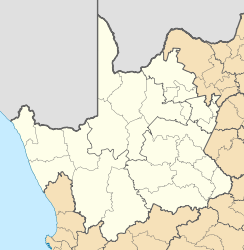
Marydale

Marydale
Marydale
Marydale (Nordkap)
Marydale
Marydale
Basisdaten
Staat Südafrika
Provinz Nordkap
Distrikt Pixley Ka Seme
Gemeinde Siyathemba
Gründung 1902
ISO 3166-2 ZA-NC
-29.38333333333322.1

Marydale ist eine Stadt in der Gemeinde Siyathemba, Distrikt Pixley Ka Seme, Provinz Nordkap in Südafrika. Die Stadt wurde 1902 gegründet durch die Niederländisch-reformierte Kirche. Benannt wurde sie nach Mary Snyman, der Frau des Besitzers der Farm Kalkput, auf dessen Besitz die Stadt lag.

Wirtschaft

Nordwestlich der Stadt gibt es größere unterirdische Wasserreserven, die Wasserversorgung der Region beruht daher hauptsächlich auf dem Einsatz von windgetriebenen Pumpen. Wirtschaftlich ist die Stadt von der Schafzucht und dem Anbau von Baumwolle abhängig. Der Abbau von Asbest ging in den letzten Jahren deutlich zurück.

Sehenswürdigkeiten

  • Köcherbaumwald: Beim nordwestlich von Marydale gelegenen Koegas findet man einen Köcherbaumwald (Aloe dichotoma)
  • archäologische Funde in der Umgebung [1]

Einzelnachweise

  1. http://www.arch.soton.ac.uk/prospectus/CAHO/afresearch.html]

Wikimedia Foundation.

Игры ⚽ Поможем написать реферат

Schlagen Sie auch in anderen Wörterbüchern nach:

  • Marydale — Country  South Africa Province Northern Cape Time zone SAST (UTC+2) …   Wikipedia

  • Marydale, Illinois —   Unincorporated community   …   Wikipedia

  • Marydale, Nova Scotia — Marydale in Nova Scotia …   Wikipedia

  • Siyathemba Local Municipality — Siyathemba Siyathemba Local Municipality Siyathemba (rot) in Nordkap Staat: Südafrika …   Deutsch Wikipedia

  • Copperton — Copperton, Northern Cape Country  South Africa Province Northern Cape Time zone SAST (UTC+2) …   Wikipedia

  • Clinton County, Illinois — Location in the state of Illinois …   Wikipedia

  • Scouting in Louisiana — has a long history, from the 1910s to the present day, serving thousands of youth in programs that suit the environment in which they live. Contents 1 Early history (1910 1950) 2 Scouting in Louisiana today 2.1 Louisiana Purchase Council …   Wikipedia

  • Damiansville, Illinois — Coordinates: 38°30′34″N 89°37′27″W / 38.50944°N 89.62417°W / 38.50944; 89.62417 …   Wikipedia

  • New Baden, Illinois — Coordinates: 38°32′8″N 89°42′0″W / 38.53556°N 89.7°W / 38.53556; 89.7 …   Wikipedia

  • Orange River — For other uses, see Orange River (disambiguation). Orange Gariep, Oranje, Senqu River …   Wikipedia

Share the article and excerpts

Direct link
Do a right-click on the link above
and select “Copy Link”