- Mayoyao
-
Municipality of Mayoyao Lage von Mayoyao in der Provinz Ifugao 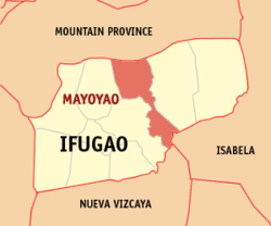
Basisdaten Bezirk: Regierungsbezirk Cordillera Provinz: Ifugao Barangays: 27 Distrikt: 1. Distrikt von Ifugao PSGC: 142706000 Einkommensklasse: 4. Einkommensklasse Haushalte: 2917 Zensus 1. Mai 2000Einwohnerzahl: 16.722 Zensus 1. August 2007Koordinaten: 16° 58′ N, 121° 13′ O16.966666666667121.21666666667Koordinaten: 16° 58′ N, 121° 13′ O Postleitzahl: 3602 Bürgermeister: Romeo O. Chulana Geographische Lage auf den Philippinen 

Mayoyao Mayoyao ist eine philippinische Stadtgemeinde in der Provinz Ifugao. Nach dem Zensus vom 1. Mai 2000 hat sie 14.191 Einwohner in 2917 Haushalten.
Baranggays
Mayoyao ist politisch in 27 Baranggays unterteilt.
- Aduyongan
- Alimit
- Ayangan
- Balangbang
- Banao
- Banhal
- Bongan
- Buninan
- Chaya
- Chumang
- Guinihon
- Inwaloy
- Langayan
- Liwo
- Maga
- Magulon
- Mapawoy
- Mayoyao Proper
- Mongol
- Nalbu
- Nattum
- Palaad
- Poblacion
- Talboc
- Tulaed
- Bato-Alatbang
- Epeng
Schlagen Sie auch in anderen Wörterbüchern nach:
Mayoyao — 16° 58′ 00″ N 121° 13′ 00″ E / 16.96666667, 121.21666667 … Wikipédia en Français
Mayoyao, Ifugao — Mayoyao Municipality Map of Ifugao showing the location of Mayoyao … Wikipedia
Mayoyao (Ifugao) — Mayoyao Carted Ifugao avec localisation de Mayoyao Mayoyao est une municipalité de la province d Ifugao, aux Philippines. Voir aussi Listes des villes des Philippines par province … Wikipédia en Français
Mayoyao Ifugao — ISO 639 3 Code : ifu ISO 639 2/B Code : ISO 639 2/T Code : ISO 639 1 Code : Scope : Individual Language Type : Living … Names of Languages ISO 639-3
Paddy field — A paddy field is a flooded parcel of arable land used for growing rice and other semiaquatic crops. Rice can also be grown in dry fields, but from the twentieth century paddy field agriculture became the dominant form of growing rice. Paddy… … Wikipedia
Aguinaldo (Ifugao) — Municipality of Aguinaldo Lage von Aguinaldo in der Provinz Ifugao Basisdaten Bezirk … Deutsch Wikipedia
Ifugao — This article refers to the province. For other uses, see Ifugao (disambiguation). Infobox Philippine province name = Ifugao sealfile = Ph seal ifugao.png region = Cordillera Administrative Region (CAR) capital = Lagawe founded = mdash;June 18,… … Wikipedia
Igorot — (pronounced IPA| [ɪgəˈrot] ) name for the people of the Cordillera region, in the Philippines island of Luzon. The Igorot form two subgroups: the larger group lives in the south, central and western areas, and is very adept at rice terrace… … Wikipedia
PH-IFU — Lage von Ifugao Ifugao ist eine Provinz im Regierungsbezirk Cordillera, auf der Insel Luzón im Norden der Philippinen. Die Hauptstadt der Provinz ist Lagawe. Ifugao dehnt sich auf … Deutsch Wikipedia
Mount Apo — The Grandfather of Philippine Mountains Elevation 2,954 m (9,692 ft) … Wikipedia
Mayoyao


18+
© Academic, 2000-2026
- Kontaktieren Sie uns: Unterstützung, Werbung
Wörterbücher Export, schritte mit PHP, Joomla, Drupal, WordPress, MODx.