Mekiro

Mekiro
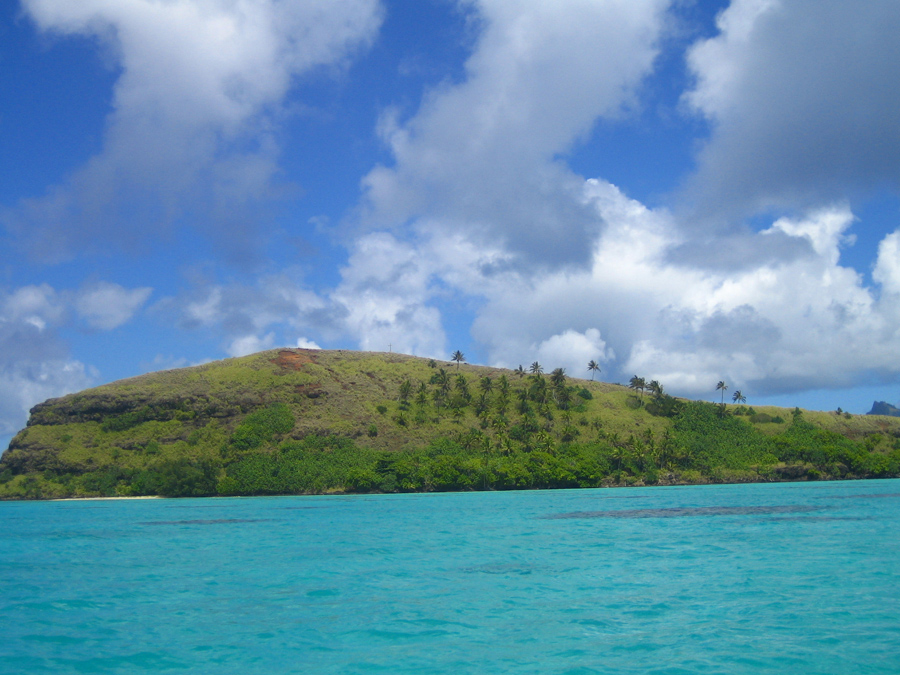
Mekiro
Mekiro von Osten aus gesehen
Gewässer Pazifischer Ozean
Inselgruppe Gambierinseln
Geographische Lage 23° 10′ 27″ S, 134° 55′ 16″ W-23.174294-134.92103660Koordinaten: 23° 10′ 27″ S, 134° 55′ 16″ W
Mekiro (Gambierinseln)
Mekiro
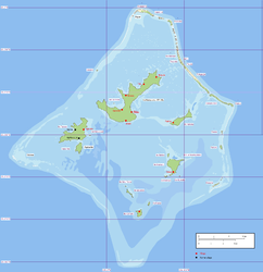
Länge 470 m
Fläche 6 ha
Höchste Erhebung 60 m
Einwohner (unbewohnt)

Mekiro ist eine Insel der Gambierinseln und gehört zu Französisch-Polynesien.

Die Insel liegt im zentralen Teil der Gambierlagune, 400 m nördlich von Akamaru. Sie ist 470 m lang und etwa 0,06 km² groß. Der höchste Punkt liegt etwa 60 m über dem Meer. Die Insel ist unbewohnt.


Wikimedia Foundation.

Игры ⚽ Поможем написать реферат

Schlagen Sie auch in anderen Wörterbüchern nach:

  • Mekiro — 23° 10′ 27″ S 134° 55′ 16″ W / 23.1743, 134.921 …   Wikipédia en Français

  • Gambier-Inseln — Lage; auf der Karte sind die Gambierinseln unten rechts abgebildet Die Gambierinseln (anderer Name Mangarevainseln) sind ein 43 Inseln umfassender Archipel östlich des 140. Längengrades im Südpazifik, etwa 1.800 Kilometer südöstlich von Tahiti.… …   Deutsch Wikipedia

  • Mangarevainseln — Lage; auf der Karte sind die Gambierinseln unten rechts abgebildet Die Gambierinseln (anderer Name Mangarevainseln) sind ein 43 Inseln umfassender Archipel östlich des 140. Längengrades im Südpazifik, etwa 1.800 Kilometer südöstlich von Tahiti.… …   Deutsch Wikipedia

  • Akamaru — Vue d Akamaru depuis Mangareva Géographie Pays …   Wikipédia en Français

  • List of islands of France — This is a list of islands of metropolitan France and French oversea islands.Ranking of French islands By area All French islands over 100 km², ranked by decreasing area. By population List of the most populated French islands.Islands of… …   Wikipedia

  • Tuamotus — Native name: Tuamotu Flag of the Tuamotu Islands …   Wikipedia

  • Gambier Islands — Infobox Islands name = Gambier Islands image caption = Flag of the Gambier Islands image size = 150px locator native name = Îles Gambier native name link = French language nickname = location = Pacific Ocean coordinates = archipelago = Polynesia… …   Wikipedia

  • Akamaru Island — Akamaru is the third largest island in the Gambier Islands of French Polynesia, at approximately 2.6 km² (1 sq. mile). The island is located approximately 8 km (5 miles) southeast of Mangareva, at coord|23|10|52|S|134|54|56|W|.The much smaller… …   Wikipedia

  • Akamaru — Gewässer Pazifischer Ozean Inselgruppe Gambierinseln …   Deutsch Wikipedia

  • Gambierinseln — NASA Bild der Gambierinseln Gewässer Pazifischer Ozean Archipel Tuamotu A …   Deutsch Wikipedia

Share the article and excerpts

Direct link
Do a right-click on the link above
and select “Copy Link”