Ardentinny

Ardentinny
Ardentinny
Koordinaten 56° 3′ N, 4° 55′ W56.042777777778-4.9102777777778Koordinaten: 56° 3′ N, 4° 55′ W
Ardentinny (Schottland)
Ardentinny
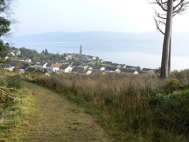
Ardentinny
Verwaltung
Post town DUNOON
Postleitzahlen­abschnitt PA23
Vorwahl 01369
Landesteil Scotland
Unitary authority Argyll and Bute
Britisches Parlament Argyll and Bute
Schottisches Parlament Argyll and Bute

Ardentinny ist ein schottisches Küstendorf mit ungefähr 150 Bewohnern, im „Argyll“-Waldpark auf dem westlichen Ufer von Loch Long am Fuß Glenfinart.

Der Ort liegt im Loch Lomond and the Trossachs National Park und zieht mit seinen Stein- und Sandstränden zu jeder Jahreszeit Besucher an. Die regelmäßigen Busverbindungen zu und von den Fähren an Hunters Quay und Dunoon geben dem Ort eine gute Verkehrsanbindung. Ardentinny kann auch auf dem Landweg über die A82 von Glasgow über die A815 und A880 erreicht werden.

Der Name Ardentinny bedeutet „Feuerhügel“, eine Ableitung, entweder vom alten Ritus der Beleuchtungsfeuer zum „God of Bels“ oder auch wegen des Leuchtfeuers früher, für die Seeleute der Fähre zwischen Ardentinny und Coulport. Diese wurde von den Herzögen von Argyll für Reisen zwischen Dunoon, Inveraray und dem Rosneath Castle benutzt. Auch die Viehhändler von Argyll, die zu den Märkten in Mittelschottland reisten, benutzten diese Verbindung.

Die örtliche Wirtschaft hat zwei wichtige Standbeine, den Tourismus und die Landwirtschaft. In Ardentinny gibt es zwei Hotels und etliche Ferienhäuser. Es gibt verschiedene Freizeitangebote wie das Ardentinny Outdoor Center, Mountainbikewege, markierte Wanderwege und Golfplätze.

In der Landwirtschaft gibt es neben der die Schaf- und Rinderzucht eine Hühnerfarm. Auch gibt es noch einen lokalen Fischer, der mit seinem Boot hauptsächlich Krabben und Garnelen fängt.

Ardentinny

Weblinks

 Commons: Ardentinny – Sammlung von Bildern, Videos und Audiodateien

Wikimedia Foundation.

Игры ⚽ Нужно сделать НИР?

Schlagen Sie auch in anderen Wörterbüchern nach:

  • Ardentinny — is a small village on the west shore of Loch Long, fourteen miles from Dunoon in Argyll on the Cowal peninsula. Nearby is Cruach a Chaise (Cheese Hill) while on the opposite side of Loch Long is the village of Coulport, home of HMNB Clyde, the… …   Wikipedia

  • Loch Lomond and the Trossachs National Park — Infobox protected area | name = Loch Lomond and The Trossachs National Park iucn category = II caption = Looking eastwards along Loch Katrine in the Loch Lomond and the Trossachs National Park locator x = locator y = location = Scotland, Argyll… …   Wikipedia

  • Dunoon and Kilmun —    DUNOON and KILMUN, a parish, in the district of Cowal, county of Argyll, 7½ miles (W. by S.) from Greenock; containing 4211 inhabitants. The early history of this parish is involved in great obscurity, and rests chiefly on tradition. Its… …   A Topographical dictionary of Scotland

  • Clan Campbell — Crest badge …   Wikipedia

  • Loch Lomond and the Trossachs National Park — DMS …   Deutsch Wikipedia

  • Clan Campbell — crest badge du clan Campbell …   Wikipédia en Français

  • 1920 in music — Events*January 19 The Salzburg Festival is revived. *Mamie Smith s first blues recordings become a hit, alerting record companies to the African American market. *Hamilton Harty is appointed resident conductor of the Hallé Orchestra. *Henri… …   Wikipedia

  • Dunoon — This article is about the town. For the small town, see Dunoon, New South Wales. Coordinates: 55°56′48″N 4°55′23″W / 55.946730°N 4.923000°W / …   Wikipedia

  • Cowal — shown within Argyll Satellite photo of Cowal Cowal (Scottish Gaelic: Còmhghall …   Wikipedia

  • Loch Long — ( Loch Long in Gaelic) is a body of water in Argyll and Bute, Scotland. The sea loch extends from the Firth of Clyde at its southwestern end. It measures approximately 20 miles in length, with a width of between one and two miles. The loch also… …   Wikipedia

Share the article and excerpts

Direct link
Do a right-click on the link above
and select “Copy Link”