- Mitiaro
-
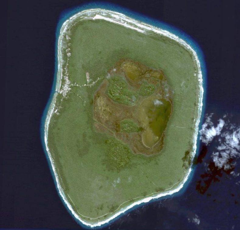
Mitiaro Satellitenbild von Mitiaro
Gewässer Pazifischer Ozean Inselgruppe Cookinseln Geographische Lage 19° 52′ 10″ S, 157° 42′ 12″ W-19.869444444444-157.7033333333311Koordinaten: 19° 52′ 10″ S, 157° 42′ 12″ W 

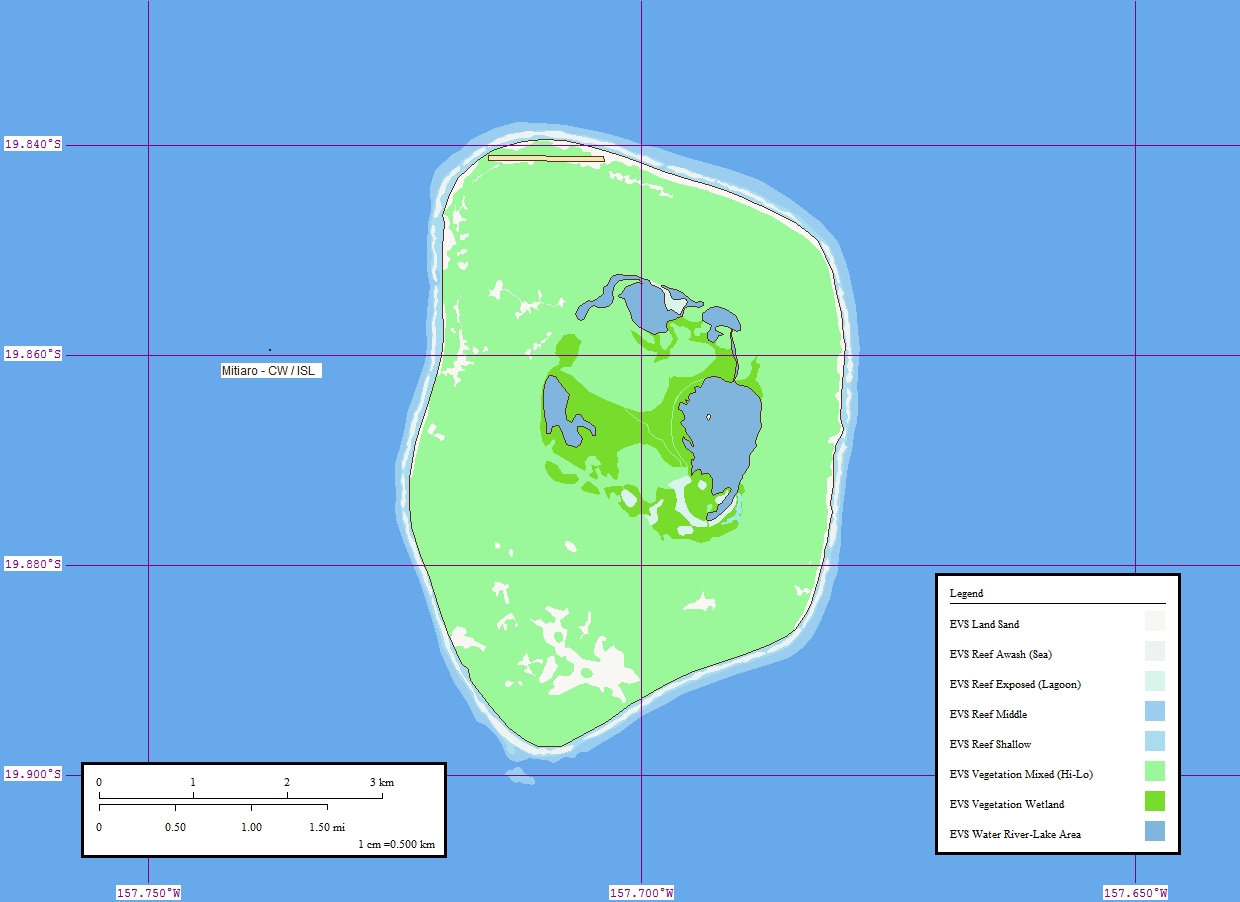
Länge 6,4 km Breite 6,0 km Fläche 22,25 km² Höchste Erhebung 11 m Einwohner 219 (2006)
9,8 Einw./km²Hauptort Arai Karte von Mitiaro
Mitiaro, auch Nukuroa genannt, ist die viertgrößte der südlichen Cookinseln.
Sie liegt etwa 37 km nordöstlich von Mauke, welches zusammen mit Mitiaro und Atiu die Inselgruppe Nga Pu Toru (etwa Die drei Wurzeln) innerhalb der Südinseln bildet. Mitiaro ist ein typisches Gehobenes Atoll mit einem Ring aus abgestorbenen Korallen, der für die Südinseln charakteristisch ist. Das Inselinnere ist weitgehend flach und verfügt mit Rotonui und Rotoiti über zwei Brackwasserseen. Mitiaro hat einen Durchmesser von 6,4 km, eine Fläche von etwa 22 km² groß und hatte bei der letzten offiziellen Volkszählung (2006) 219 Einwohner, die hauptsächlich in den Siedlungen Takaue und Arai leben. Mitiaro hat keinen Hafen, aber einen Flughafen, den Mitiaro oder Nukuroa Airport (IATA: MOI, ICAO: NCMR), der ausschließlich von Air Rarotonga angeflogen wird.
Die Hauptexportprodukte Mitiaros sind Itiki, eine endemische Aalart, und Tiporo, eine Limettenart; die Bewohner leben aber meist vom Tourismus oder als Selbstversorger.
Der erste Europäer auf Mitiaro war der Missionar John Williams, der die Insel am 20. Juli 1823 mit der Endeavour (nicht zu verwechseln mit James Cooks gleichnamigem Schiff) besuchte.
Quellen
- evs-islands.com (englisch)
- Bevölkerungsstatistik.de
Schlagen Sie auch in anderen Wörterbüchern nach:
Mitiaro — Location … Wikipedia
Mitiaro — Vue satellite de Mitiaro. Géographie Pays … Wikipédia en Français
Mitiaro — es la cuarta isla por tamaño del archipiélago de las Islas Cook. Como casi todas las demás islas, Mitiaro es de origen volcánico y se eleva 14, 750 pies sobre la placa marina. El punto más ancho de la isla es de 6,4 km. Se encuentra rodeada por… … Wikipedia Español
Mitiaro (Cook Islands electorate) — Mitiaro Mitiaro is a Cook Islands electoral division returning one member to the Cook Islands Parliament. Its current representative is Tangata Vavia, who has held the seat since 1994. The electorate consists of the island of Mitiaro. Contents … Wikipedia
Mitiaro Airport — (also known as Nukuroa Airport) (IATA: MOI, ICAO: NCMR) is an airport on Mitiaro in the Cook Islands. It has a runway that is 25 feet above sea level and 3,000 feet long. Airlines and destinations Airlines Destinations Air Rarotonga… … Wikipedia
Mitiaro (circonscription) — Circonscriptions électorales des îles Cook Mitiaro Elections 2006 Tangata Mouauri Vavia 2004 Tangata M … Wikipédia en Français
Mitiaro — ▪ island, Cook Islands, Pacific Ocean island in the southern Cook Islands, a self governing state in free association with New Zealand in the South Pacific Ocean. It is a raised coral atoll and is encircled by a reef. Its interior of… … Universalium
Nukuroa — Mitiaro Satellitenbild von Mitiaro Gewässer Pazifischer Ozean Inselgruppe Cookinseln … Deutsch Wikipedia
Cook Islands — For individual islands named Cook Island , see Cook Island (disambiguation). Cook Islands Kūki Āirani … Wikipedia
Cook-Inseln — Cook Islands Kūki Āirani Cookinseln … Deutsch Wikipedia
- Kontaktieren Sie uns: Unterstützung, Werbung
Mitiaro

18+
© Academic, 2000-2026
Wörterbücher Export, schritte mit PHP, Joomla, Drupal, WordPress, MODx.