Moree Plains Shire

Moree Plains Shire
Shire of Moree Plains
Australia-Map-NSW-LGA-MoreePlains.png
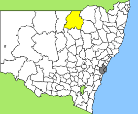
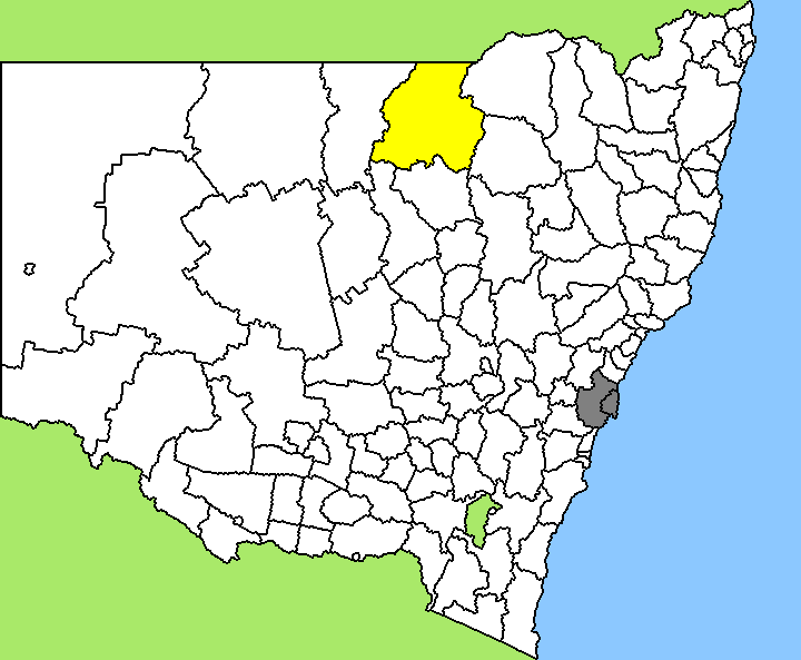
Lage des Moree Plains Shire in New South Wales
Gliederung
Staat: Australien Australien
Bundesstaat: Flag of New South Wales.svg New South Wales
Verwaltungssitz: Moree
Daten und Zahlen
Fläche: 17.928 km²
Einwohner: 13.976 (2006) [1]
Bevölkerungsdichte: 0,8 Einwohner je km²
-29.333333333333149.78333333333

Moree Plains Shire ist ein lokales Verwaltungsgebiet (LGA) im australischen Bundesstaat New South Wales. Das Gebiet ist 17.928 km² groß und hat etwa 15.000 Einwohner.

Moree Plains liegt im Norden des Staates an der Grenze zu Queensland etwa 650 km nördlich der Metropole Sydney und 475 km südwestlich von Brisbane. Das Gebiet umfasst 79 Ortsteile und Ortschaften, darunter Boggabilla, Gurley, Moree, Mungindi, Pallamallawa und Weemelah. Der Sitz des Shire Councils befindet sich in Moree in der Osthälfte der LGA, wo etwa 8.000 Einwohner leben.

Verwaltung

Der Moree Plains Shire Council hat zwölf Mitglieder, die von den Bewohnern der LGA gewählt werden. Moree Plains ist nicht in Bezirke untergliedert. Aus dem Kreis der Councillor rekrutiert sich auch der Mayor (Bürgermeister) des Councils.

Weblinks

Einzelnachweise

  1. Australian Bureau of Statistics (25. Oktober 2007): Moree Plains (A) (Local Government Area) (Englisch). 2006 Census QuickStats. Abgerufen am 6. April 2010.

Wikimedia Foundation.

Игры ⚽ Поможем решить контрольную работу

Schlagen Sie auch in anderen Wörterbüchern nach:

  • Moree Plains Shire — New South Wales Location in New South Wales Population …   Wikipedia

  • Moree Plains Shire Council — Infobox Australian Place | type = lga name = Moree Plains Shire state = nsw caption = Location in New South Wales pop = 15,680Census 2001 AUS|id=LGA15300|name=Moree Plains (A) (Local Government Area)|accessdate=2007 06 30] area = 17928 est = seat …   Wikipedia

  • Moree — Hauptstraße Staat …   Deutsch Wikipedia

  • Moree, New South Wales — For the town in Ghana, see Moree, Ghana. Moree New South Wales Main street, Moree …   Wikipedia

  • Shire of Waggamba — Infobox Australian Place | type = lga name = Shire of Waggamba state = qld imagesize= 180 caption = Location within Queensland pop = 2,963 area = 13500 est = seat = Goondiwindi region = logosize = 140 url = http://www.waggamba.qld.gov.au/ near nw …   Wikipedia

  • Wakool Shire — Shire of Wakool New South Wales Location in New South Wales Population: 4,427(2009) …   Wikipedia

  • Narrabri Shire — New South Wales Population: 13,693(2009) …   Wikipedia

  • Gwydir Shire Council — Infobox Australian Place | type = lga name = Gwydir Shire state = nsw caption = Location in New South Wales pop = 5,530 cite web publisher = Australian Bureau of Statistics title=Regional Population Growth, Australia, 2004 05 url = http://abs.gov …   Wikipedia

  • Muswellbrook Shire — New South Wales Location in New South Wales Population …   Wikipedia

  • Cowra Shire — New South Wales Location in NSW Population: 12,945(2009) …   Wikipedia

Share the article and excerpts

Direct link
Do a right-click on the link above
and select “Copy Link”