Motukawao Islands

Motukawao Islands
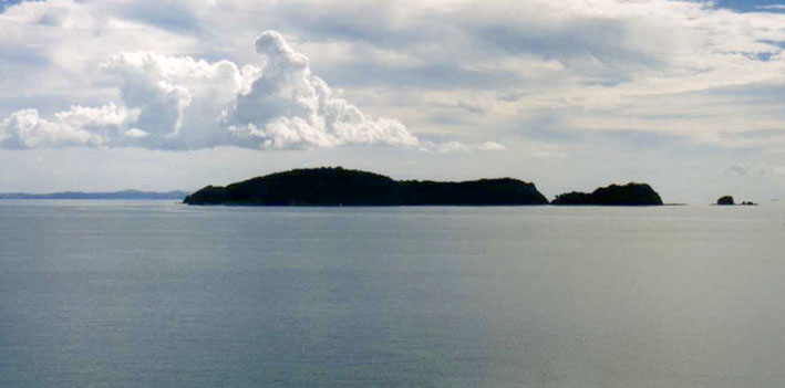
Motukawao Islands
Motukawao Islands im Hauraki Gulf, Sicht von der Amodeo Bay nahe Colville
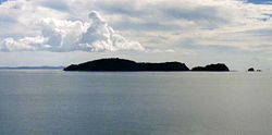
Gewässer Pazifik
Geographische Lage 36° 41′ S, 175° 24′ O-36.69175.4Koordinaten: 36° 41′ S, 175° 24′ O
Motukawao Islands (Neuseeland)
Motukawao Islands
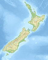
Anzahl der Inseln Motuwi, Ngamotukaraka; Moturua, Motukaramarama
Gesamtfläche dep1
Einwohner (unbewohnt)

Die Motukawao Islands sind eine Inselgruppe im Nordosten der der Nordinsel Neuseelands. Sie sind die nördlichste einer Reihe von Inselgruppen im Hauraki Gulf vor der Westküste der Coromandel-Halbinsel. Sie liegen etwa 5 km südwestlich von Colville und sind unbewohnt. Die größten Inseln der Gruppe sind Motuwi und Ngamotukaraka, weitere Inseln sind Moturua und Motukaramarama.


Wikimedia Foundation.

Игры ⚽ Поможем сделать НИР

Schlagen Sie auch in anderen Wörterbüchern nach:

  • Motukawao Islands — Maori: Motukawao Motukawao Islands and Hauraki Gulf from Amodeo Bay, near Colville. Geography Location Waikato Region …   Wikipedia

  • List of islands of New Zealand — New Zealand consists of a large number of islands. The two main islands, which are much larger than the rest and where most of the population lives, are the North Island and the South Island. The latter is often a little ironically referred to as …   Wikipedia

  • Coromandel Peninsula — This article is about the Coromandel Peninsula in New Zealand. For the similarly named region in India, see Coromandel Coast. Location of Coromandel Peninsula …   Wikipedia

  • Коромандел (полуостров) — Коромандел Координаты: Координаты …   Википедия

  • Liste von unbewohnten Inseln und Inselgruppen (Pazifischer Ozean) — In die Liste unbewohnter Inseln und Inselgruppen (Pazifischer Ozean) gehören nur im Pazifischen Ozean (und seiner Nebenmeere) gelegene Inseln, Inselgruppen oder Atolle, die entweder noch nie von Menschen bewohnt waren oder seit längerer Zeit… …   Deutsch Wikipedia

  • Hauraki Gulf — The Hauraki Gulf is a coastal feature of the North Island of New Zealand. It has a total area of 4000 km² [http://www.int res.com/articles/meps/126/m126p267.pdf] Zeldisl, J. R. et al (1995) Salp grazing: effects on phytoplankton abundance,… …   Wikipedia

  • Liste neuseeländischer Inseln — Diese Liste führt die Inseln Neuseelands auf. Neben den zwei Hauptinseln gehören eine Reihe von Inseln in der Hauptkette, Binneninseln und die von Neuseeland teils sehr weit entfernten Outlying Islands zu Neuseeland. Außerdem sind einige… …   Deutsch Wikipedia

  • Colville, New Zealand — Colville …   Wikipedia

Share the article and excerpts

Direct link
Do a right-click on the link above
and select “Copy Link”